Catalog Archive
Auction 126, Lot 93

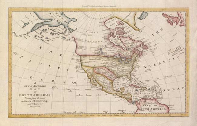
"A New & Accurate Map of North America; Drawn from the most Authentic Modern Maps and Charts", Bowen, Thomas

Subject: North America

Period: 1778 (published)

Publication: Middleton's Complete System of Geography

Color: Hand Color

Size:
17 x 10.3 inches
43.2 x 26.2 cm
Download High Resolution Image
(or just click on image to launch the Zoom viewer)

Map of North America that is particularly interesting for its depiction of the Pacific Northwest that is labeled Parts Unknown. Alaska is shown as the island of Alaschka in the Northern Archipelago. The discoveries of Bering and Tschirikow (1741), Juan de Fuca (1592) and Martin d'Aguilar (1603) are noted along the coastline. The mythical West Sea is noted above New Albion but not delineated. The British colonies are shown with boundaries on the Mississippi River. Louisiana is wedged between the Mississippi and New Mexico, which incorporates Texas. Indian tribes are noted throughout.

References:

Condition: A

Issued folded, now flattened with some folds reinforced on verso with tissue.

Estimate: $350 - $450

Sold for: $300

Closed on 12/3/2008

Archived