Catalog Archive
Auction 126, Lot 840

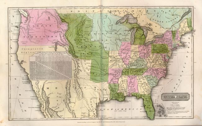
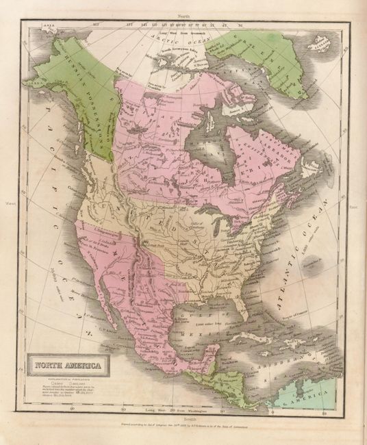
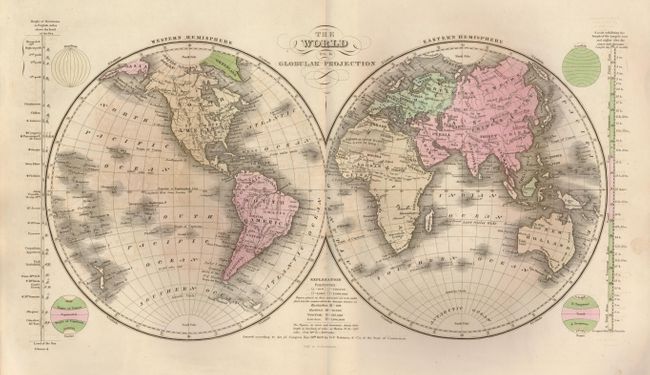
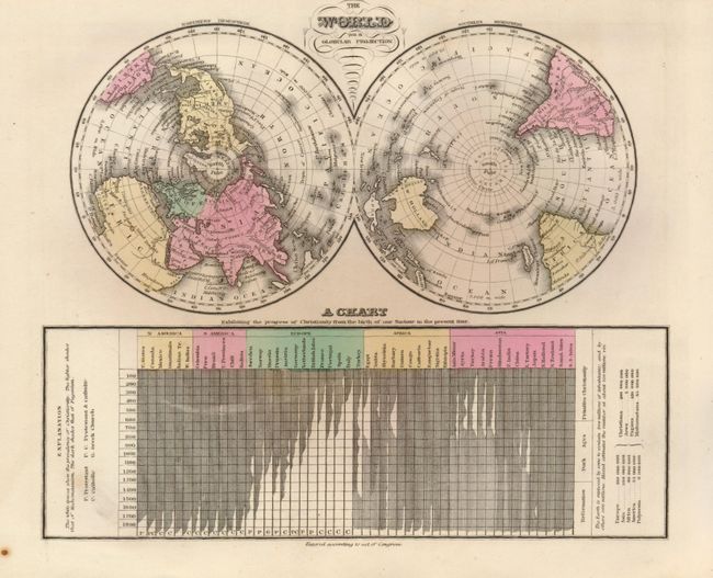
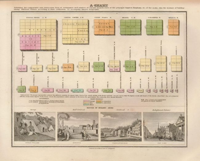
"A New and Improved School Atlas, to Accompany the Practical System of Modern Geography", Olney, Jesse

Subject: Atlases

Period: 1837 (published)

Publication:

Color: Hand Color

Size:
9.5 x 11.5 inches
24.1 x 29.2 cm
Download High Resolution Image
(or just click on image to launch the Zoom viewer)

Nice example of Olneys' atlas complete with twelve well engraved and hand colored maps. The maps are either dated 1828-29 or are not dated. The cartography in the United States shows Wisconsin Territory between Lake Michigan and the Missouri River. The large Missouri Territory extends from the Missouri River to Oregon Territory and south to include Indian Territory. On the North American and United States maps, the boundary in the Northwest extends well into British America per the "Boundary determined in 1824." Northern California is "Unexplored Region." The Independent Republic of Texas is called out. Maps included are: world in hemispheres (dp), world with thematic chart of religions, North America, United States, Eastern States, Middle States, Southern States, Western States (Missouri through Ohio), South America, Europe, Asia and Africa. The thirteenth engraving is a thematic chart showing the comparative size, population and forms of government with four engraved vignettes including Morocco, Constantinople and New York. Printed paper covers that double as the title page and list of maps. Published by Robinson, Pratt & Company.

References:

Condition: A

Maps are very good to fine. Cover with just a little soiling or staining. Hand coloring and impressions are particularly nice.

Estimate: $220 - $300

Sold for: $170

Closed on 12/3/2008

Archived