Catalog Archive
Auction 126, Lot 784

"A New & Accurate Chart of the Discoveries made by the Late Capt. Js. Cook … Exhibiting Botany Bay with the whole Coast of New South Wales in New Holland; also New Zealand…", Bowen, Thomas

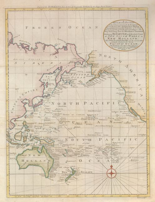
Subject: Pacific Ocean

Period: 1787 (circa)

Publication: Bankes's New System of Geography

Color: Hand Color

Size:
13.5 x 18 inches
34.3 x 45.7 cm
Download High Resolution Image
(or just click on image to launch the Zoom viewer)

This detailed map covers the whole Pacific with its many islands and the adjoining coastlines. It focuses on the discoveries of Capt. Cook during his three voyages of discovery in the Pacific, in which he charted the eastern coastline of Australia, circumnavigated New Zealand, and discovered numerous islands including the Hawaiian Islands.

References:

Condition: B+

Issued folded, now flattened. There is some faint foxing and a small abrasion at bottom right, else very good.

Estimate: $400 - $500

Sold for: $240

Closed on 12/3/2008

Archived