Catalog Archive
Auction 126, Lot 779
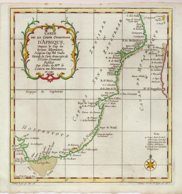
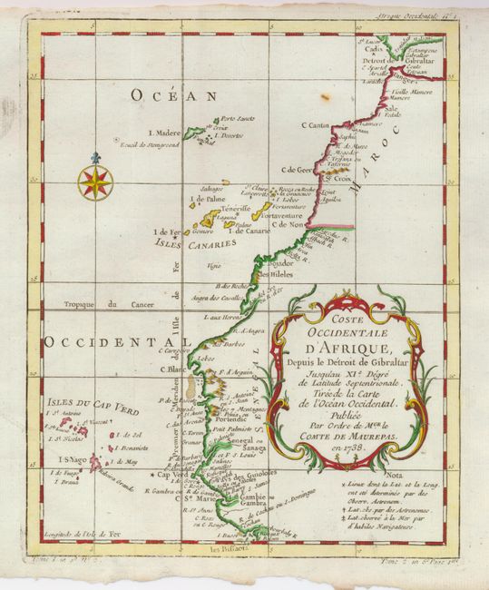
"[Lot of 2] Carte de la Coste Orientale d'Afrique depuis le Cap de Bonne Esperence… en 1740 [and] Coste Occidentale d'Afrique depuis le Detroit de Gibraltar… en 1738", Bellin, Jacques Nicolas
1 of 2
Subject: Africa - Southeastern and Northwestern
Period: 1750 (circa)
Publication: Prevost's Histoire Generale des Voyages
Color: Hand Color
Size:
See Description
Download High Resolution Image
(or just click on image to launch the Zoom viewer)
(or just click on image to launch the Zoom viewer)