Catalog Archive
Auction 126, Lot 566

"Tavola di Pomerania con tutti i pui degni prencipati, citta terre & rocche", Munster, Sebastian

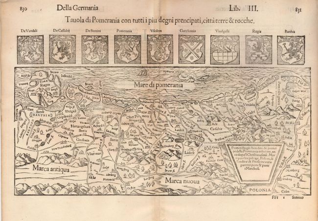
Subject: Poland and Germany

Period: 1560 (circa)

Publication: Cosmographia

Color: Black & White

Size:
15 x 6.5 inches
38.1 x 16.5 cm
Download High Resolution Image
(or just click on image to launch the Zoom viewer)

This is a very interesting woodblock map of the historic region of Pomerania on the shores of the Baltic Sea. The map covers from Rugen (present-day Germany) to Hel (Poland). The interior features are pictorially presented with mountains, forests, rivers, marshes, roads and towns. The sea is teeming with sea monsters. Nine crests are above map. Italian text and a woodblock illustration on verso.

References:

Condition: B+

Light toning along centerfold with a small binding hole in the bottom margin, well away from the map.

Estimate: $200 - $275

Sold for: $150

Closed on 12/3/2008

Archived