Catalog Archive
Auction 126, Lot 529

"Carte de l'Ancienne Ville de Lyon",

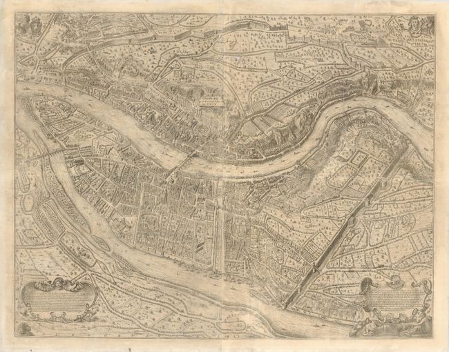
Subject: France, Lyon

Period: 1696 (published)

Publication: Histoire Civile ou Consulaire de la Ville de Lyon

Color: Black & White

Size:
33.5 x 26 inches
85.1 x 66 cm
Download High Resolution Image
(or just click on image to launch the Zoom viewer)

This incredible rarity was published in 1696 by Nicoloas Henri Tardieu on two sheets, here joined. The plan has incredible detail showing all streets and buildings, walls and fortifications, bridges, parks, hotels and much more. It is oriented with north to the right. It is decorated with the coats-of-arms of France and the city of Lyon, wind heads (Eurus, Aust and Chorus) at three corners, and two large cartouches, one decorated with allegorical representations of the Saone and Rhone. The text in the cartouches explains that the map shows the city as it was under the reigns of Francois I and Henri II. Tardieu was commissioned by Father Claude François Menestrier, the famous Jesuit historian from Lyon, to engrave the illustrations and this map for his Historie Civil. A remarkable map and a significant rarity.

References:

Condition: B+

Professionally removed from previous backing. The center joining doesn't match up well at bottom. The map has no significant flaws and has wide margins.

Estimate: $2,000 - $3,000

Unsold

Closed on 12/3/2008

Archived