Catalog Archive
Auction 126, Lot 493

"Le Canal et Partie dela France", Mortier/Fricx
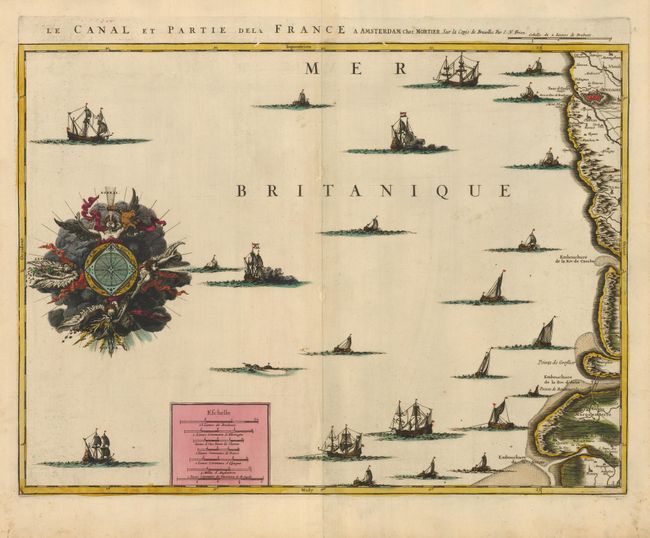
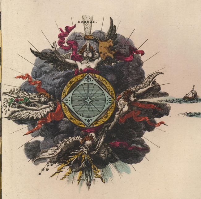
Subject: English Channel

Period: 1706 (circa)

Publication:

Color: Hand Color

Size:
22 x 16.3 inches
55.9 x 41.4 cm
Download High Resolution Image
(or just click on image to launch the Zoom viewer)

This is a rare and exquisitely graphic map of the English Channel showing the coast of France from Baie de la Somme to Boulogne-sur-Mer. The Channel is filled with an assortment of ships and fishing craft. The highlight of the map is the unusual compass rose, which is set within a cloud background with some of the most elaborate wind heads we have ever seen. In the north is Boreas, the strongest of all winds and god of winter, with the Ursa Major constellation and Polaris. To the east is Eurus with his blustery wind filling the sail of a ship. In the south is the cadaverous Auster with his plague-carrying, hot summer winds. And finally, the west-wind Zephyrus, known as the messanger of spring, gently whispers his fruitful wind.

References:

Condition: B

A superb impression and original color. There are several worm tracks along centerfold and in margins that have been backed with a sheet of early nineteenth century paper for a previous binding.

Estimate: $300 - $400

Sold for: $275

Closed on 12/3/2008

Archived