Catalog Archive
Auction 126, Lot 468

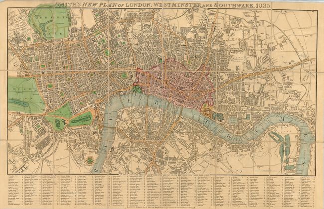
"Smith's New Plan of London, Westminster and Southwark", Smith, Charles
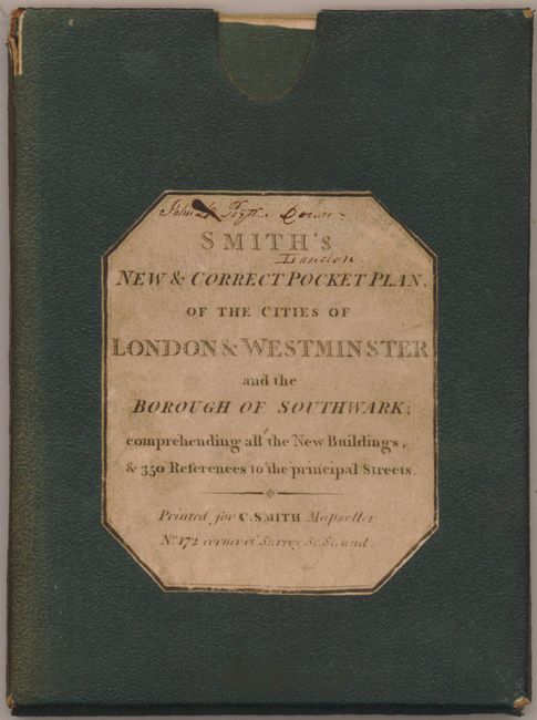
Subject: England, London

Period: 1835 (dated)

Publication:

Color: Hand Color

Size:
24.8 x 13.3 inches
63 x 33.8 cm
Download High Resolution Image
(or just click on image to launch the Zoom viewer)

This fabulous folding tourist map is dissected into 18 panels and backed with linen. It slips into the original green cloth hard case (4.5 x 6") with paper label "Smith's New & Correct Pocket Plan, of the Cities of London & Westminster and the Borough of Southwark; Comprehending all the New Buildings, & 350 References to the Principal Streets." The map is centered on Fleet Street and extends to show Regent's Park in the northwest, Hyde Park in the west and east to the Breach on the Thames. Extensive "Alphabetical List of 350 Principal Streets with Reference to their Situation" is along the bottom. On original linen with green cloth thumb-tabs thoughtfully positioned to assist in removing the map case without soiling the linen.

References:

Condition: A

This is an exceptional example less a small, unobtrusive signature on case above title and another on back of map. Spine of cover sunned.

Estimate: $200 - $300

Sold for: $230

Closed on 12/3/2008

Archived