Catalog Archive
Auction 126, Lot 389

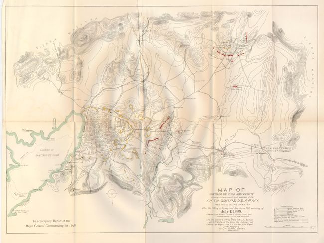
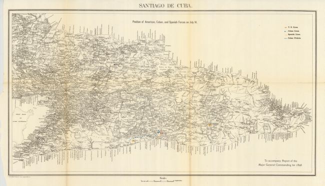
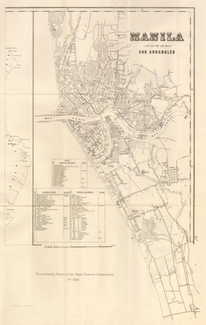
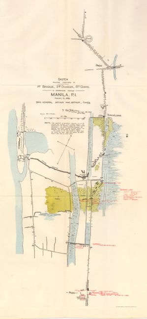
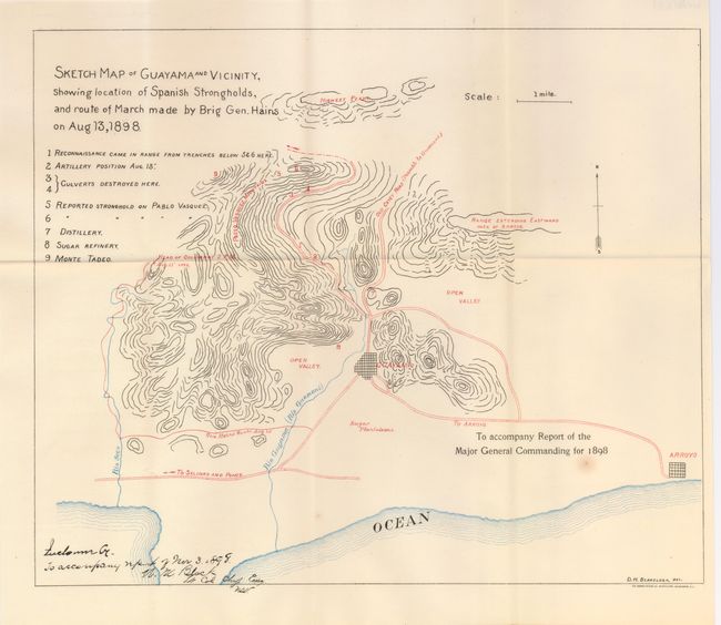
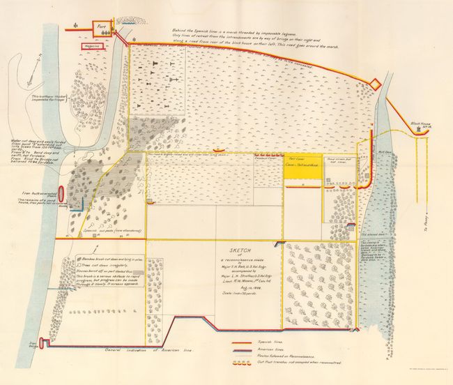
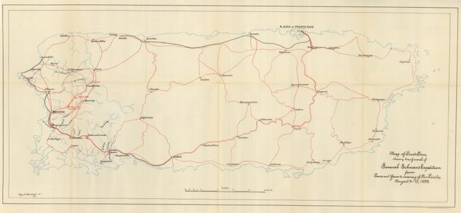
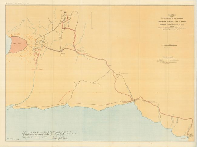
"[Lot of 14 - Spanish-American War]", U.S. War Department

Subject: Spanish-American War, Cuba Puerto Rico and Philippines

Period: 1898 (dated)

Publication: Report of the Major General Commanding

Color: Printed Color

Size:
See Description
Download High Resolution Image
(or just click on image to launch the Zoom viewer)

A great assortment of battle maps from Cuba, Puerto Rico and the Philippines published in the Report of the Major General Commanding, 1898. This Spanish American War lot includes:

1. "Map of Santiago de Cuba and Vicinity…after the taking of Caney and San Juan Hill, evening of July 1st, 1898," printed color, 22" x 16", (A).
2. "Santiago de Cuba. Positions of American, Cuban and Spanish Forces on July 14," printed color, 25" x 14, (B+).
3. "Manila Sus Arrabales," b&w, 14" x 22", (A+).
4. "Sketch showing positions of 1st Brigade, 2nd Division, 8th Corps. In Operations against Manila, P.I. August 13, 1898," printed color, 10" x 21", (A+).
5. "Sketch Map of Guayama and Vicinity, showing location of Spanish Strongholds, and route of March made by Brig Gen. Hains on Aug 13, 1898," printed color, 15.2" x 13", (A+).
6. "Sketch of a reconnaissance made by Major T.H. Bett, U.S. Vol. Engr…," printed color, 16" x 13", (A+).
7. "Map of Puerto Rico, showing line of march of General Schwan's Expedition from Ponce and Yancoto crossing of Rio Prieto, August 9 - 15, 1898," printed color, 28" x 12.5", (A+).
8. "Sketch showing the Operations of the Command of Brigadier General John C. Bates in the Campaign against Santiago de Cuba…," printed color, 29.8" x 21.5", (A).
9. "Map of Santiago de Cuba and Vicinity. Showing Entrenchments and position of the 5th Corps U.S. Army and those of the Spanish," printed color, 23" x 16", (B+).
10. "Map Showing Country South of River Dasig and West of River Paranaque…," printed color, 14" x 18", (A+).
11. [untitled map] showing Old Fort and military positions, artillery piece, and bridge blown up over the San Juan River, b&w, 16" x 9", (A).
12. "Road Sketch showing the Marches of the Independent Brigade VI Corps (Bates') from Siboney to Encaney and the Position before Santiago…July 1st 1898," b&w, 10" x 8", (A+).
13. "Map of Battle field of August 10th, 1898. Between U.S. Regular troops under Brig. Genl. Theodore Schwan, and Spanish forces under Col. Julio Soto Villanueva. Alfonso XIII," printed color, 9.5" x 14", (A+).
14. "Map of the spanish and american trenches on the south of Manila…," printed color, 15" x 18", (A+).

References:

Condition:

See individual descriptions.

Estimate: $200 - $300

Sold for: $160

Closed on 12/3/2008

Archived