Catalog Archive
Auction 126, Lot 356

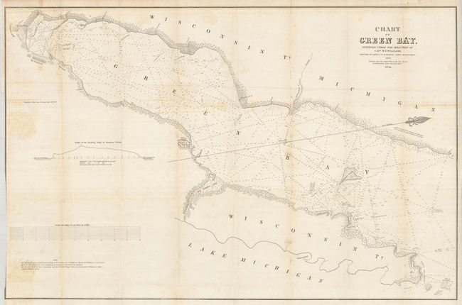
"Chart of Green Bay. Surveyed under the Direction of Capt. W.G. Williams… Reduced from the Original Map…", U.S. War Department

Subject: Wisconsin, Green Bay

Period: 1846 (dated)

Publication:

Color: Black & White

Size:
34.5 x 22.5 inches
87.6 x 57.2 cm
Download High Resolution Image
(or just click on image to launch the Zoom viewer)

This large map describes the area from Ft. Howard and the village of Green Bay north though Green Bay to its mouth with Lake Michigan to include part of Washington Island. There is good detail along the shoreline with many place names. Bay Settlement, Red Banks with ruins nearby, Little and Big Sturgeon Bays, and much more are located. The extensive soundings and shoreline detail are taken from the 1843 map by Capt. J. McClellans map. The Door Peninsula is shown in its entirety, but with little interior detail. The map is oriented with north to the right. It was made under the assistance of Lieut. J.W. Gunnison, Corps of Topl. Engrs. Gunnison would later perish in 1853 at the hands of Indians near Delta, Utah.

References:

Condition: B+

Binder's trim at left edge trimmed to neatline, as issued. A little occasional foxing, mostly on some folds.

Estimate: $120 - $240

Sold for: $60

Closed on 12/3/2008

Archived