Catalog Archive
Auction 126, Lot 354

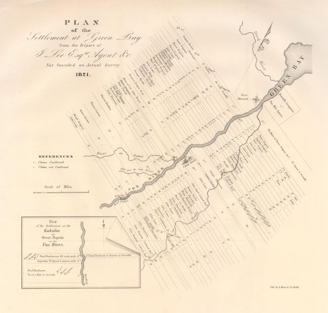
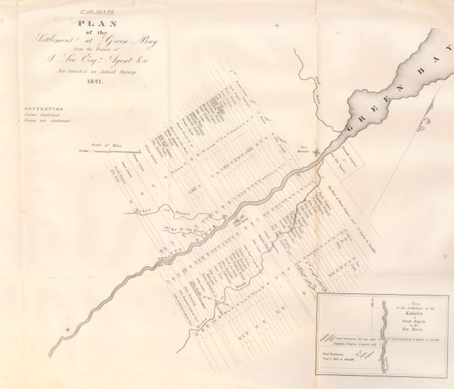
"[Lot of 2] Plan of the Settlement at Green Bay from the Report of J. Lee Esqre. Agent &c.", U.S. Government

Subject: Wisconsin

Period: 1821-1860 (published)

Publication:

Color: Black & White

Size:
See Description
Download High Resolution Image
(or just click on image to launch the Zoom viewer)

This lot has two examples of the same map of Green Bay, one from the original 1821 publication (20th Cong., 1st Sess., 13.5" x 12.5"), the other is the reprint from the 1860 American State Papers, Public Lands No. 598, Vol. V., c. 1860, 17.5" x 14.5". The original map shows "long lot" claims along the Fox River at Green Bay, Wisconsin Territory. Each claim includes claimant's name, area and status (confirmed or non-confirmed.) Camp Smith, Fort Howard, a mill and the Fox's tributaries are located. The larger reprint has minor alterations. A pair of early maps of settlement of Green Bay, both dated 1821 but published 1827 and circa 1860.

References:

Condition: A

Both are very good. One has a little toning at one fold.

Estimate: $250 - $350

Unsold

Closed on 12/3/2008

Archived