Catalog Archive
Auction 126, Lot 350

"Map of the City of Richmond, Va.",

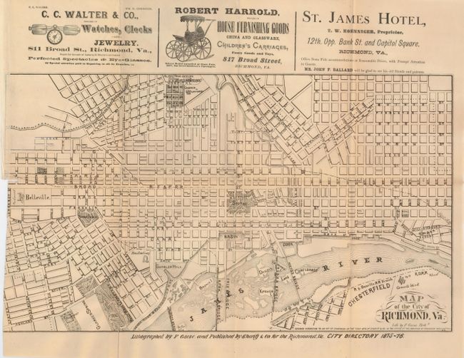
Subject: Virginia, Richmond

Period: 1876 (dated)

Publication:

Color: Black & White

Size:
18 x 10.5 inches
45.7 x 26.7 cm
Download High Resolution Image
(or just click on image to launch the Zoom viewer)

A rare issue that was lithographed by F. Geese and published by Sherift & Co., for the Richmond (Virginia) City Directory of 1875-76. All streets are named with most still matching the town today. Locates Gambels Hill Park, Capital Square, Monroe Square, Richmond College, Colored Alms House and much more. North is oriented 45° to the left but this is not indicated on the sheet. A few streets are also noted in Chesterfield as is the Granite Work. Illustrated advertisements run across the top for the St. James Hotel; Robert Harrold; and C.C. Walter & Co. Blank verso.

References:

Condition: B+

Folding as issued. Some fold splits with archival tissue tape repairs on verso. Binding side with very short tear.

Estimate: $180 - $220

Sold for: $250

Closed on 12/3/2008

Archived