Catalog Archive
Auction 126, Lot 339

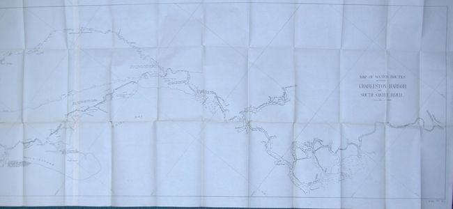
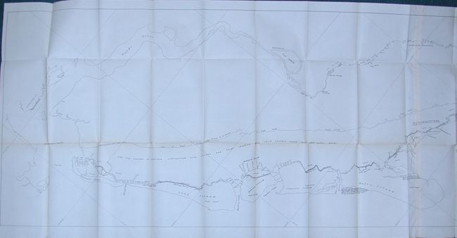
"Map of the Water Routes between Charleston Harbor and South Santee Pass", U.S. Government

Subject: South Carolina

Period: 1899 (dated)

Publication: HR. Doc. 84, 56th Congress, 1st Session

Color: Black & White

Size:
20.5 x 79 inches
52.1 x 200.7 cm
Download High Resolution Image
(or just click on image to launch the Zoom viewer)

Uncommon chart shows the area from Charleston and the Cooper River north along the shoreline to the South Santee River. It delineates numerous islands including Sullivan's, Long, Cat (in Ward's Creek), Mill, Horse Head, Bulls and locates McClellanville and the Withewood plantation. This huge sheet has remarkable detail on a scale of 3000 feet per inch. Several interesting surveying notations locate the benchmark "on the head of galvanized nail in the middle plank of the wharf" and another "is on a galvanized nail in the trunk of Scrub Oak nearest the end of wharf." We find no references or attribution for this chart.

References:

Condition: B+

Remarkable condition for a map of this size. A little toning along one fold and some fold intersections splits along same fold line.

Estimate: $100 - $150

Unsold

Closed on 12/3/2008

Archived