Catalog Archive
Auction 126, Lot 302

"Cram's Railroad & Township Map of Michigan", Cram, George F. & Company
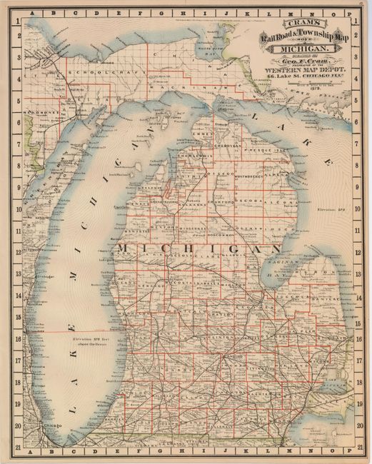
Subject: Michigan

Period: 1879 (dated)

Publication: Cram's Standard American Atlas of the United States

Color: Hand Color

Size:
16.7 x 21.2 inches
42.4 x 53.8 cm
Download High Resolution Image
(or just click on image to launch the Zoom viewer)

Rare map from the first edition of Cram's most celebrated atlas. The extensive railway system extends as far north as Petosky. All counties are delineated and scores of towns and villages are located. The map extends to show most of the Upper Peninsual and parts of Illinois and Wisconsin along the Lake Michigan shoreline. Title is in Victorian-style letting. The map carries the date of 1879 with a copyright date of 1878. The imprint is Cram's Western Map Depot, 66 Lake St. Chicago, Ills. There was a close relationship between the Cram and Watson firms, who also published from this address. This Lake Street address was the home to Cram's publishing company between 1873 and 1879, thereafter moving to Wabash Avenue.

References: Chicago Map Makers: "George F. Cram and the American Perception of Space" Gerald A. Danzer

Condition: A+

Fine example with beautiful original hand coloring and strong impression.

Estimate: $140 - $180

Sold for: $150

Closed on 12/3/2008

Archived