Catalog Archive
Auction 126, Lot 298

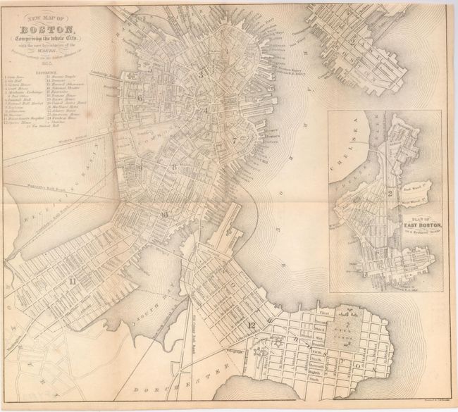
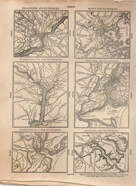
"[Lot of 2] New Map of Boston, Comprising the Whole City, with the New Boundaries of the Wards [and] [6 U.S. City Plans]",

Subject: Boston, Massachusetts and US cities

Period: 1831-55

Publication:

Color: Black & White

Size:
See Description
Download High Resolution Image
(or just click on image to launch the Zoom viewer)

1) New Map of Boston, Comprising the Whole City, with the New Boundaries of the Wards, by George W. Boynton (10.8 x 9.5") from the Boston Almanac, 1855. Shows the city before part of the Receiving Basin was filled to create Commonwealth Avenue and Back Bay neighborhood. Printed on banknote paper, folding as issued, trimmed into neatline at upper right for binding (B).

2) Six small plans on a single sheet (9 x 12"): Philadelphia and its Environs, Boston and its Environs, Washington City and its Environs, New-York and its Environs, Charleston (S.C.) and its Environs, and Baltimore and its Environs. The copyright at bottom credits Cooke & Co., 1831. Unrelated English text on verso. Crumpled paper edges, else fine (A).

References:

Condition:

see description.

Estimate: $120 - $160

Unsold

Closed on 12/3/2008

Archived