Catalog Archive
Auction 126, Lot 295

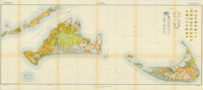
"Soil Map Dukes and Nantucket Counties Massachusetts", U.S. Government

Subject: Massachusetts

Period: 1825 (dated)

Publication: Soil Survey of Dukes and Nantucket Counties, Mass. By W.J. Latimer

Color: Hand Color

Size:
52.5 x 21 inches
133.4 x 53.3 cm
Download High Resolution Image
(or just click on image to launch the Zoom viewer)

This large, colorful map details Martha's Vineyard and Nantucket Island. It extends to show Wood's Hole and the Elizabeth Islands. There is remarkable detail of roads, lakes, villages and towns with even some individual buildings noted. The legend keys to 25 various soil types using different colors and patterns. This folding map comes with the original 31-page report "Soil Survey of Dukes and Nantucket Counties, Mass." by W.J. Latimer.

References:

Condition: A

The map is near fine less some light toning along folds.

Estimate: $200 - $300

Sold for: $240

Closed on 12/3/2008

Archived