Catalog Archive
Auction 126, Lot 289

"Grundriss von Neu-Orleans", Bellin, Jacques Nicolas

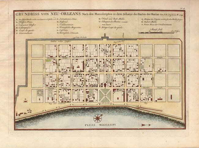
Subject: Louisiana, New Orleans

Period: 1744 (dated)

Publication: Allgemeine Historie der Reisen zu Wasser und zu Lande

Color: Hand Color

Size:
11 x 7.5 inches
27.9 x 19.1 cm
Download High Resolution Image
(or just click on image to launch the Zoom viewer)

Attractive plan of the city of New Orleans detailing the city center, including Bourbon Street, with individual buildings depicted and keyed to a list under the title. Locates the quay along the Mississippi River, the canal, government buildings, church, prison, hospital, monastery, army and navy quarters. The plan became the definitive map of New Orleans throughout the eighteenth century. This is the German edition, dated 1744, but published in 1756 by Arkstee & Merkus.

References: cf Lemmon, Magill & Wiese #171.

Condition: A

Faint damp stains in blank margins.

Estimate: $300 - $400

Sold for: $220

Closed on 12/3/2008

Archived