Catalog Archive
Auction 126, Lot 279

"Carte des Iles Hawaii pour servir au Voyage pittoresque autour du Monde", Dumont d'Urville, Jules Sebasian Cesar
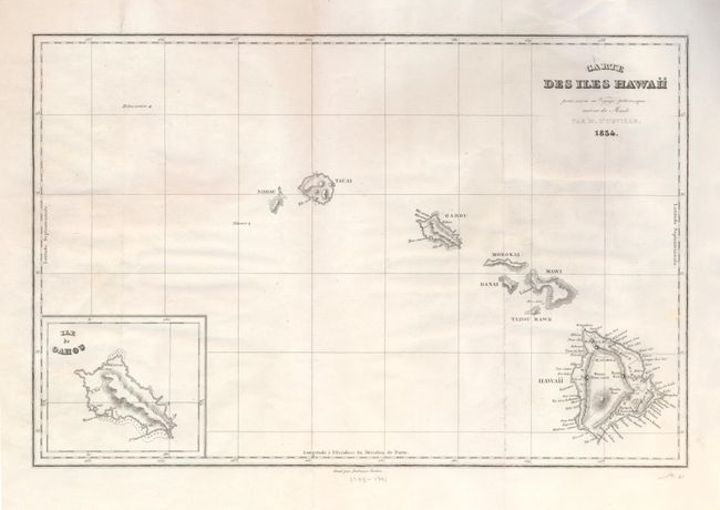
Subject: Hawaii

Period: 1834 (dated)

Publication: Voyage Pittoresque autour de Monde

Color: Black & White

Size:
13 x 8.7 inches
33 x 22.1 cm
Download High Resolution Image
(or just click on image to launch the Zoom viewer)

A fine chart of the Hawaiian Islands with an inset of the Ile de Oahou. Dumont d'Urville circumnavigated the globe for the second time between 1826 and 1829. On this expedition his accomplishments included significant Pacific discoveries. His records were so detailed that for the first time the scattered islands of the South Pacific could be divided into three major groups: Melanesia, Polynesia and Micronesia. Although the expedition did not pass through Hawaii, this map is interesting as it is a very early (and perhaps the first) use of the native name Hawaii for the entire island chain. An uncommon map in original uncolored state.

References: Not listed in Fitzpatrick.

Condition: A

Nice, clean example with full original margins. Mounting tape on verso at top edge.

Estimate: $240 - $275

Sold for: $220

Closed on 12/3/2008

Archived