Catalog Archive
Auction 126, Lot 276

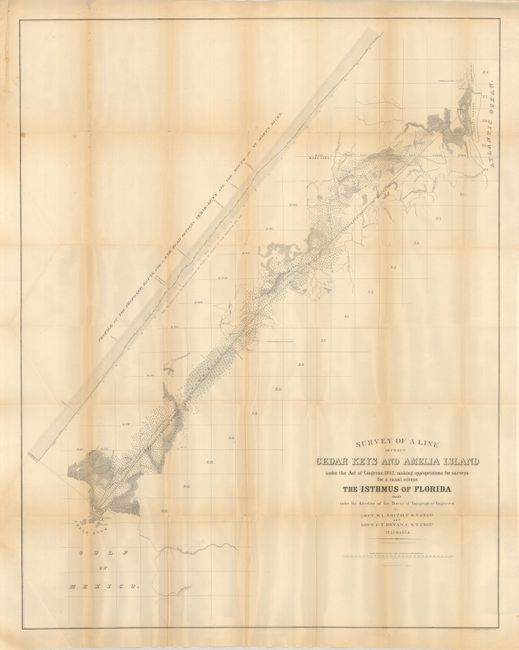
"Survey of a Line between Cedar Keys and Amelia Island … for a Canal across the Isthmus of Florida 1853 &1854", U.S. War Department

Subject: Florida

Period: 1855 (circa)

Publication:

Color: Black & White

Size:
26.5 x 33.5 inches
67.3 x 85.1 cm
Download High Resolution Image
(or just click on image to launch the Zoom viewer)

Despite the title, the map depicts the route of the proposed railroad, not canal. Completed in 1861, it was the first railroad in Florida to connect the Atlantic Ocean and the Gulf of Mexico. The map was created by Lieuts. M.L. Smith and F.T. Bryan, U.S.T. Engrs 1853 & 1854. Very detailed, it has a scale of 4.5 miles per inch. Early and interesting features include many roads, Daniel's house (north of Cedar Keys), villages, and more. There is good topography and watershed detail with an elevation plan following the rail route. This uncommon maps is a reduced issue from the original.

References:

Condition: B

With some fold toning and fold intersection splits.

Estimate: $100 - $140

Sold for: $60

Closed on 12/3/2008

Archived