Catalog Archive
Auction 126, Lot 267

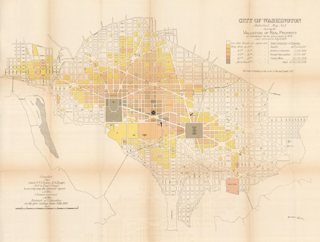
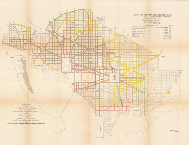
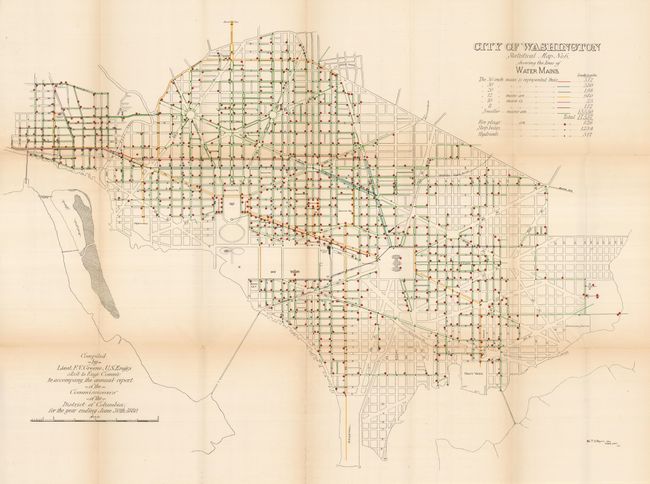
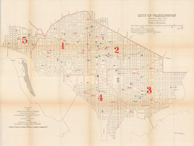
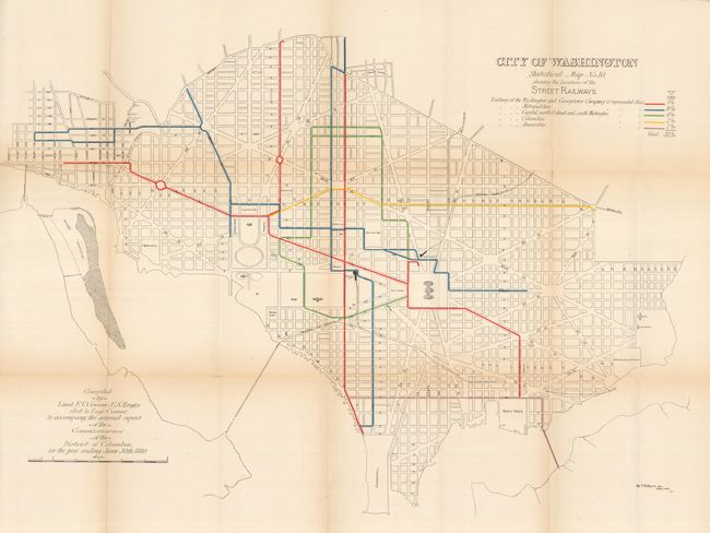
"[Lot of 12] City of Washington Statistical Map Nos.1-12", U.S. Government

Subject: District of Columbia

Period: 1880-81 (published)

Publication: Annual Report of the Commissioners of the District of Columbia

Color: Printed Color

Size:
29.5 x 21 inches
74.9 x 53.3 cm
Download High Resolution Image
(or just click on image to launch the Zoom viewer)

This is the first edition and the complete set of the twelve original Greene maps published to show the large-scale improvements in the infrastructure of the city. These maps were compiled by Lieut. F.V. Greene to accompany the annual report of the commissioners of the District of Columbia, for the year ending June 30th 1880. Each map carries the title "Statistical Map No.__," is drawn on an identical scale and shows the street pattern of Washington. Each has a specialized focus, e.g. valuation of real estate, street grade, varieties of street pavements, shade trees, sewers, water supply and distribution, street lamps, public schools, police and fire department stations, street railways, scheduled street sweeping, and underground cables. Very interesting details emerge from the maps, e.g., there were 1266 telegraph poles with 30.5 miles of line and 436 miles of wire; New Jersey Ave. was paved with wood and swept once each month. This important and complete set of twelve matched maps in their first edition provide a remarkable look into the capital's infrastructure in the early 1880's. The set is in the best condition we've seen.

References:

Condition: B+

This set is on heavy paper which due to its thickness has occasional small fold intersection splits. A little toning on some folds, still the best example we've seen of this set.

Estimate: $500 - $700

Sold for: $375

Closed on 12/3/2008

Archived