Catalog Archive
Auction 126, Lot 266

"Topographical Map of the District of Columbia Showing the Projected Harbor Improvement, System of Main Drainage and County Roads, as Corrected to 1880", Boschke, A.

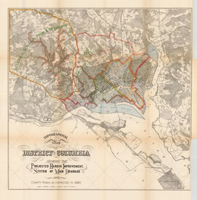
Subject: District of Columbia

Period: 1880 (dated)

Publication:

Color: Printed Color

Size:
20 x 20 inches
50.8 x 50.8 cm
Download High Resolution Image
(or just click on image to launch the Zoom viewer)

Extraordinary detail is presented in this 1880 update of Boschke's 1861 map of the city and vicinity of Washington, D.C. Broschke, a draughtsman for the Coastal Survey department surveyed the city at his own expense in the years 1856-59 with an eye to selling the map to the government. Instead he was fired for neglect of official duty with the plates seized by the government. The larger 1861 edition was published on two sheets. This map uses the partial cadastral projection to show the region which includes some householders' names, individual buildings, and vegetation. Relief is shown by contours and hachure. In the Potomac are scores of depth soundings plus contours. The map includes a portion of the Virginia shoreline. This updated edition adds color and a large section at upper left labeled "Available Site for Park & Reservoir." The original edition located Mary Ann Hall's brothel, omitted in this edition. Oriented with north toward the upper left. With fancy Victorian-style titling. A most uncommon issue.

References:

Condition: B+

Lovely color and impression on fine thick paper. A very nice example of a scarce map with just a little fold toning.

Estimate: $300 - $400

Sold for: $150

Closed on 12/3/2008

Archived