Catalog Archive
Auction 126, Lot 228

"Map of Oregon, Washington, Idaho, and Part of Montana", Mitchell, Samuel Augustus

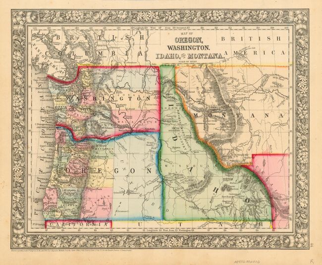
Subject: Northwestern United States

Period: 1863 (published)

Publication:

Color: Hand Color

Size:
12 x 9.3 inches
30.5 x 23.6 cm
Download High Resolution Image
(or just click on image to launch the Zoom viewer)

This decorative stone engraved map shows the region at the end of its transitional border period. It features the newly formed Wyoming area that is still unnamed from its previous designation as "Attached to Dakota." In this configuration the northwestern corner is triangular and extends as a wedge between Idaho and Montana. The new territories of Idaho and Montana have no organized counties. Eastern Washington is shown with only three counties, and Oregon's eastern portion is noted only as unexplored and has only about 19 of its eventual 36 counties. The map notes places so important to navigation, such as Ft. Boise, Ft. Bonneville, the Three Buttes, several gold mining areas including Elk City, and much more. The Emigrant Route, or the Oregon Trail, winds across from South Pass, following the route of the Snake River and ending at Walla Walla. Surrounded by Mitchell's attractive first edition floral border. A scare issue showing borders which existed for a very short period.

References:

Condition: A+

Beautiful bright color and strong impression.

Estimate: $140 - $160

Sold for: $70

Closed on 12/3/2008

Archived