Catalog Archive
Auction 126, Lot 218

"Johnson's Nebraska, Dakota, Idaho, Montana and Wyoming", Johnson, A. J.

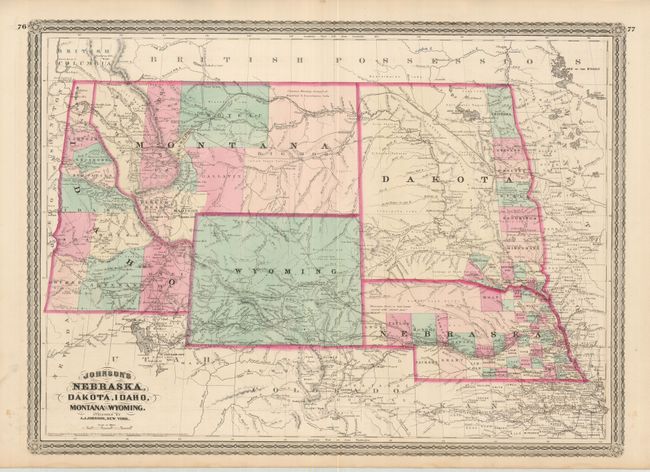
Subject: Western United States

Period: 1865 [70] (dated)

Publication: Johnson's New Illustrated Family Atlas

Color: Hand Color

Size:
23 x 16.5 inches
58.4 x 41.9 cm
Download High Resolution Image
(or just click on image to launch the Zoom viewer)

This handsome map is centered on the newly created Wyoming Territory (1868) which as yet shows no county development. Montana is shown, which, along with Wyoming, was previously contained in a large Idaho territory. Idaho Territory has ten organized counties. In Montana Pompey's Pillar is located as are the forts of C.F. Smith, Sarpy, Galpin, and more. Gold deposits are noted in south central Montana above Yellowstone, which will not appear for three more years. Excellent detail throughout with scores of towns and villages named, trails, wagon roads, immigrant roads, railroads, forts and more. Topography is shown via hachure and watershed is well developed. Features Johnson's later border.

References:

Condition: A

The map image is fine with a few spots in the margins. Lovely original hand color, strong impression with full margins.

Estimate: $120 - $160

Sold for: $80

Closed on 12/3/2008

Archived