Catalog Archive
Auction 126, Lot 20

"Nova et Accuratissima Totius Terrarum Orbis Tabula", Blaeu, Johannes
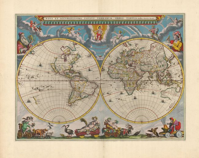
Subject: World

Period: 1663 (circa)

Publication: Le Grand Atlas

Color: Hand Color

Size:
21.5 x 16 inches
54.6 x 40.6 cm
Download High Resolution Image
(or just click on image to launch the Zoom viewer)

This splendid world map is one of the most elegantly engraved maps from the Dutch golden age of cartography. Presented in two hemispheres, it is beautifully decorated with the figures of Mercator and Ptolemy along with a host of celestial beings in the clouds above the map. Allegorical representations of the four seasons, seated in chariots quaintly drawn by pairs of beasts and birds, are arrayed across the bottom. The map is based on his important wall map of 1648, but updated with a different interpretation of the island of California, the northern part of which is labeled Nova Albion and with Pt. Sr. Franco Draco located. The small partial coastline of Anian appears on the northwest coast of North America. Blaeu's unique representation of the Great Lakes region consisting of a single, large lake dominates the region west of the British colonies. The explorations of Tasman are evident in the Pacific, where two coastlines of New Zealand are delineated. The eastern coastline of Asia is severely truncated, Korea appears as an island, and the interior of China is dominated by large spurious lakes. Australia is partially mapped based on the Dutch explorations in the region. This map is much rarer than Blaeu's carte-a-figures world map that appeared in the Blaeu atlases prior to 1662. It was prepared for the eleven volume Atlas Maior, first published in a Latin text edition in 1662. It then appeared in the French editions in 1663 and 1667, in Dutch (1664), and in German (1667), prior to the destruction of the Bleau printing works in a fire in 1672. This is from a French edition with French text on verso.

References: Shirley #428.

Condition: A

Fine impression and beautiful old color. There are a couple tiny worm holes and a repaired, fold separation in the bottom margin, well away from the map.

Estimate: $15,000 - $20,000

Sold for: $11,500

Closed on 12/3/2008

Archived