Catalog Archive
Auction 126, Lot 209
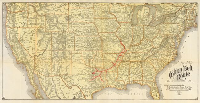
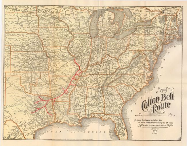
"[Lot of 2] Map of the Cotton Belt Route… St. Louis Southwestern Railway Co. of Texas", Railroad Companies, (Various)
1 of 2
Subject: United States - South Central
Period: 1900 (circa)
Publication:
Color: Printed Color
Size:
See Description
Download High Resolution Image
(or just click on image to launch the Zoom viewer)
(or just click on image to launch the Zoom viewer)