Catalog Archive
Auction 126, Lot 165

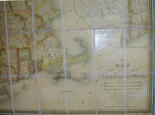
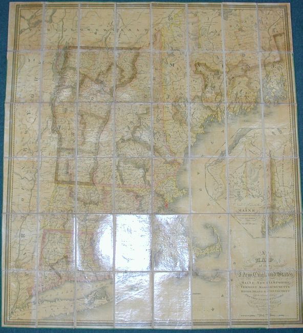
"A Map of the New England States, Maine, New Hampshire, Vermont, Massachusetts, Rhode Island & Connecticut with the Adjacent Parts of New York & Lower Canada", Hale, Nathan

Subject: New England

Period: 1826 (dated)

Publication:

Color: Hand Color

Size:
40 x 44 inches
101.6 x 111.8 cm
Download High Resolution Image
(or just click on image to launch the Zoom viewer)

First edition of this most uncommon map of New England which includes an updated border for Maine. Normally seen as a wall map, this example is dissected, linen-backed, with silk cloth along the egdes. It folds into original marbled slipcase (5.5 x 7.8"). The map details the region from Long Island through New England and up the Hudson Valley to north of Lake Champlain. Maine is shown in a large inset titled "Northern & Eastern Part of Maine and Part of Lower Canada and New Brunswick." The map is finely engraved and filled with a remarkable amount of information considering the date of publication. The legend locates roads and turnpikes, towns and villages, the boundaries of states, counties and cities, the finished and unfinished railroads and more. Below Moosehead Lake is "Bingham's purchase 1,000,000 Acres." Very fancy title lettering and a finely engraved piano keyboard-style border embellish. Engraved by J.V.N. Throop and copyrighted by Hale on the 14th day of August 1826. Marbled paper panels are on the ends of the folded map. The mapmaker shares the name and is the nephew of the patriot Nathan Hale. A rare issue in remarkable condition.

References: Phillips (M) p.472; Rumsey #2265 (1827 version).

Condition: A

This map is fine, its original varnish is bright with little to no sign of darkening. Most of the original green silk piping is present at map's edge. The slipcase has some wear at edges and corners, and has the original owner's name in ink on front and hand lettered title on spine.

Estimate: $1,500 - $3,000

Sold for: $900

Closed on 12/3/2008

Archived