Catalog Archive
Auction 126, Lot 157

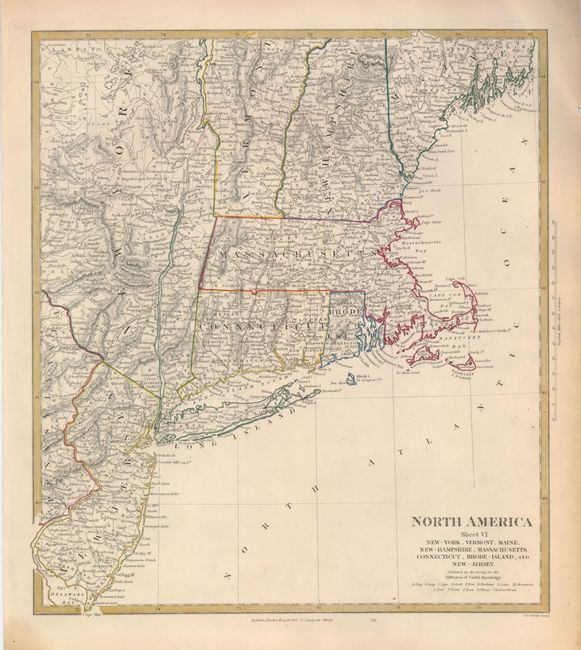
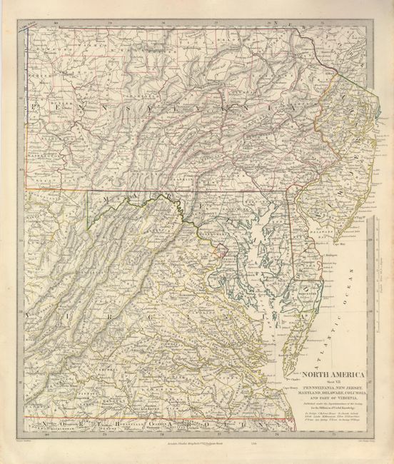
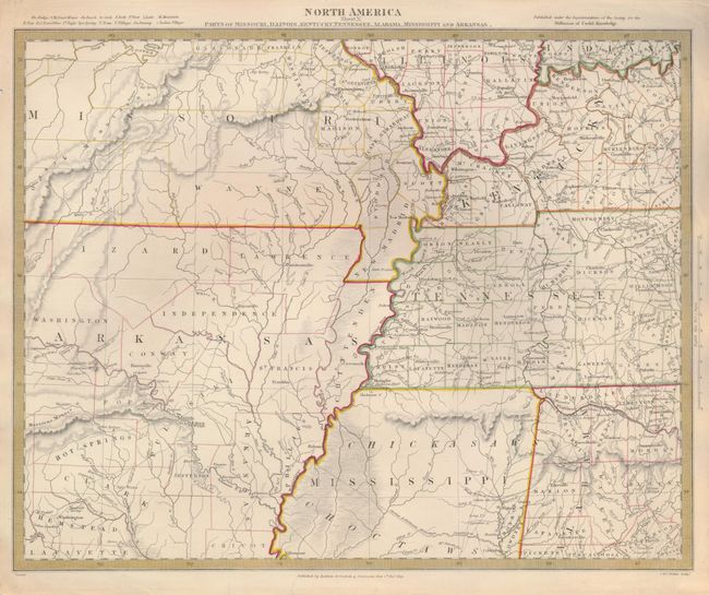
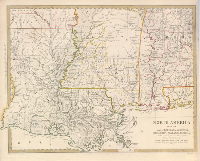
"[Lot of 4 - Regional Maps]", SDUK Society for the Diffusion of Useful Knowledge

Subject: Eastern United States

Period: 1833 (circa)

Publication:

Color: Hand Color

Size:
12.3 x 13.8 inches
31.2 x 35.1 cm
Download High Resolution Image
(or just click on image to launch the Zoom viewer)

This lot of regional maps provide a remarkable amount of detail including cities, forts, Indian villages, roads, mines, bridges, court houses, post offices, springs and much else of interest. They are from a series of maps of North America published in the first half of the nineteenth century.

1) North America Sheet VI New-York, Vermont, Maine, New-Hampshire, Massachusetts, Connecticut, Rhode-Island, and New-Jersey.
2) North America Sheet VII Pennsylvania, New Jersey, Maryland, Delaware, Columbia and Part of Virginia.
3) North America Sheet X Parts of Missouri, Illinois, Kentucky, Tennessee, Alabama, Mississippi and Arkansas.
4) North America Sheet XIII Parts of Louisiana, Arkansas, Mississippi, Alabama & Florida.

References:

Condition: A

Original outline color with a few short marginal tears.

Estimate: $200 - $300

Sold for: $150

Closed on 12/3/2008

Archived