Catalog Archive
Auction 126, Lot 125

"A Map of North America from the Latest Surveys and Maps", Blair, Rev. John

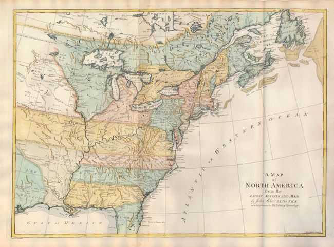
Subject: Colonial United States and Canada

Period: 1768 (circa)

Publication: Chronology and History of the World

Color: Hand Color

Size:
22 x 16 inches
55.9 x 40.6 cm
Download High Resolution Image
(or just click on image to launch the Zoom viewer)

Superb map of the continent published during the transitional period leading up to the American Revolution. The map shows much of the region controlled by the British after the French and Indian War. Several of the colonial charters extend to an indeterminate western boundary. The charter and dates are noted along the colonial boundaries, which extend through Louisiana, a Spanish possession at the time. Another conflicting boundary is New Mexico's eastern line, which travels north along the R. Mexicano (Sabine River) before turning northwest where it intersects with Virginia and Carolina's border. This map, finely engraved by Thomas Kitchin, shows a good amount of detail regarding topography and watershed, Indian lands, settlements, fishing banks, and more.

References: McCorkle #768.2.

Condition: A

This beautiful example is fine less a small amount of centerfold toning at top and bottom mostly in blank margins. Crisp, early impression and full hand coloring on a superb sheet of hand laid paper with original margins. Two large watermarks.

Estimate: $900 - $1,100

Sold for: $600

Closed on 12/3/2008

Archived