Catalog Archive
Auction 126, Lot 114

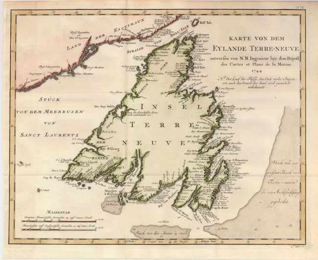
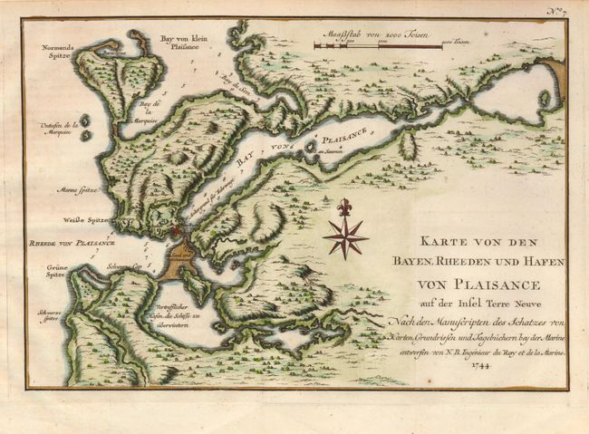
"[Lot of 2] Karte von dem Eylande Terre-Neuve… [and] Karte von den Bayen, Rheeden und Hafen von Plaisance aus der Insel Terre Neuve", Bellin, Jacques Nicolas

Subject: Canada, Newfoundland

Period: 1744 (dated)

Publication: Allgemeine Historie der Reisen zu Wasser und zu Lande

Color: Hand Color

Size:
See Description
Download High Resolution Image
(or just click on image to launch the Zoom viewer)

Two finely engraved charts of Newfoundland from the German edition published by Askstee & Merkus in 1756.

1) Karte von dem Eylande Terre-Neuve… (14 x 11") focuses on Newfoundland and shows a part of the mainland at upper left and includes the Strasse von Bell' Isle and part of the Gulf of St. Lawrence. Blank interior, but there is good detail along the coastlines with a remarkable number of place names. The bay and harbor of Plaisanceis noted on the southern coast. Several shoals and fishing banks are indicated through full stippling in the sea, with soundings noted. There are two scales of miles at lower left.
2) Karte von den Bayen, Rheeden und Hafen von Plaisance aus der Insel Terre Neuve (11.2" x 7.6") details the region around Plaisance, a former French colony, on Newfoundland's southern coast. Details Placentia Bay (here Bay von Plaisance), the nearby battery, and much topographical information, soundings, etc.

References: Kershaw #516.

Condition: A

Issued folding, now flattened. There are some tiny worm tracks in upper margin, not affecting the first map.

Estimate: $240 - $300

Sold for: $180

Closed on 12/3/2008

Archived