Catalog Archive
Auction 126, Lot 108

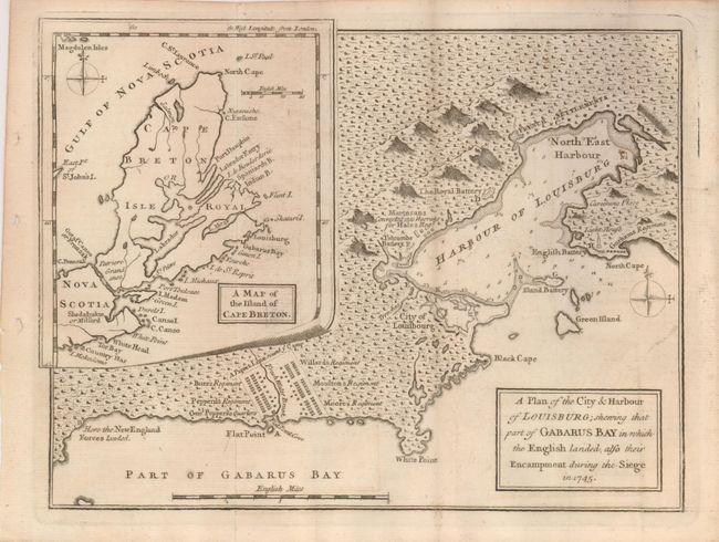
"A Plan of the City & Harbour of Louisburg; shewing that part of Gabarus Bay in which the English landed, also their Encampment during the Siege in 1745", Anon.
Subject: Canada

Period: 1758 (published)

Publication: Gentleman's Magazine

Color: Black & White

Size:
10 x 7.5 inches
25.4 x 19.1 cm
Download High Resolution Image
(or just click on image to launch the Zoom viewer)

This historical map is pre-French and Indian War covers the vicinity of Louisburg with batteries, light house, military quarters, etc. It shows the fortified city of Louisburg, the French Settlement, Black Cape, White Cape, the location were the New England Forces landed and of several regiments, and more. The large inset at upper right is "A Map of the Island of Cape Brenton" which includes part of Nova Scotia to Country Har. Territorial disputes developed between the British and French which led to the 1750 conference in Paris to try to solve these disputes. No settlement was reached which soon led to the French and Indian War. This March 1758 map has a compass rose in the main map and another in the inset.

References: Jolly GENT-114.

Condition: B+

Folding as issued the map has just a little offsetting, otherwise very good.

Estimate: $140 - $160

Sold for: $70

Closed on 12/3/2008

Archived