Catalog Archive
Auction 125, Lot 933

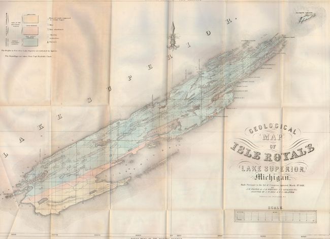
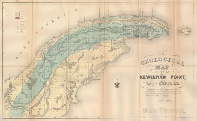
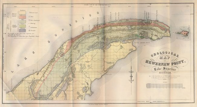
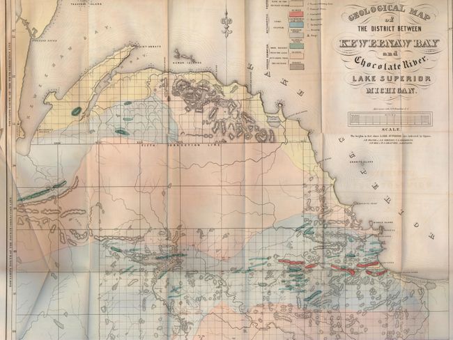
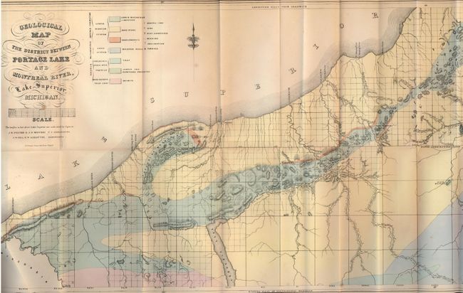
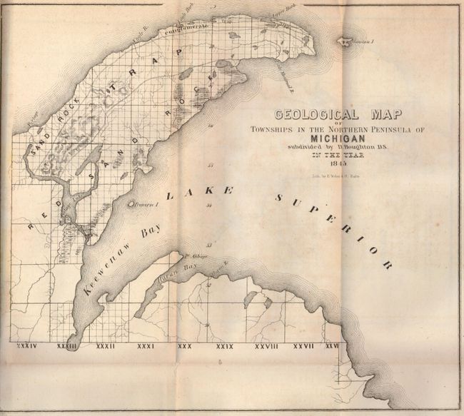
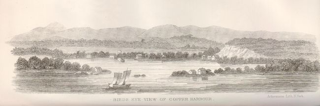
"Geological and Mineralogical Reports by Charles T. Jackson", General Land Office

Subject: Exploration and Surveys, Michigan

Period: 1849 (published)

Publication: HR Ex. Doc. No. 5, 31st Congress, 1st Session

Color: Hand Color

Size:
6 x 9 inches
15.2 x 22.9 cm
Download High Resolution Image
(or just click on image to launch the Zoom viewer)

This is an extensive and informative report on the geological and mineralogical survey of the mineral lands in Michigan lying south of Lake Superior and north and northwest of Lake Michigan. The purpose of the survey was to determine which lands should be classified "mineral lands" and which "agricultural lands". Included in the congressional mandate was a provision for the establishment of a General Land Office in the northern part of Michigan to manage the sale of the state's mineral lands. Jackson spent two seasons on this project and then resigned. The work was completed by two of his assistants, J.D. Whitney and J.W. Foster. It contains four small plans and the following five hand colored geological maps:

1) Geological Map of Isle Royale Lake Superior, Michigan Foster and Whitney. (25 x 17.5").
2) Geological Map of Keweenaw Point, Lake Superior by Jackson. (22.5 x 13.5"). Disbound.
3) Geological Map of Keweenaw Point, Lake Superior by Foster and Whitney. (20.5 x 10.6").
4) Geological Map of the District between Keweenaw Bay and Chocolate River by Foster and Whitney. (24 x 19").
5) Geological Map of the District between Portage Lake and Montreal River, Lake Superior, Michigan by Foster and Whitney. (29.5 x 15.4"). Misfolded.

There are an additional five uncolored maps listed as follows:

6) Geological Map of Townships in the Northern Peninsula of Michigan (10 x 9").
7) Geological Map of a District of Township Lines of Michigan by W.A. Burt (11.5 x 9.8").
8) Geological Map of Township Lines in the Northern Peninsula of Michigan by W.A. Burt (10.4 x 7").
9) Geological Map of a District E & W of the Ontonagon by Higgins & Hubbard (17.4 x 9.8").
10) Geological Map of the District Subdivided By the Messrs. Hubbard & Ives (15.3 x 7.8")

Complete volume with 935 pages, 8vo. Hardbound in original sheepskin with gilt titling over red and black bands on spine. Overall a nice example of this important report.

References:

Condition: B

Text pages with occasional foxing, visible at edges. Maps and plans have occasional foxing and some minor fold splits. One map is disbound. Covers have some light scuffing and a small area of insect damage to front cover, splits at spine, and wear to spine with some loss at head and foot. Signatures are tight.

Estimate: $600 - $800

Sold for: $300

Closed on 9/24/2008

Archived