Catalog Archive
Auction 125, Lot 848

"Johnson's China East Indies Australia and Oceanica", Johnson & Browning

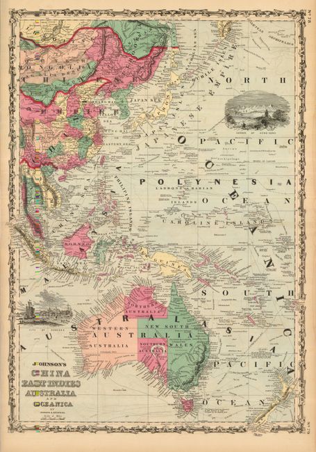
Subject: South Pacific Ocean

Period: 1860 (circa)

Publication: Illustrated Family Atlas of the World

Color: Hand Color

Size:
17 x 24.5 inches
43.2 x 62.2 cm
Download High Resolution Image
(or just click on image to launch the Zoom viewer)

Centered on the Caroline Islands the map extends west to include Siam and Sumatra and eastward to show Fiji, New Zealand and the last few islands in the Aleutian archipelago. Impressive sheet features the "Great Wall said to be 1500 miles long, 30 feet thick, 15 to 30 feet high", vignettes of the harbor of Hong-Kong and the city of Bangkok, and explorers' routes. This spectacular double page map is surrounded by Johnson's first edition border.

References:

Condition: B+

Very bright, early impression with strong, original coloring on a sheet with full margins. A little offsetting in blank areas.

Estimate: $100 - $140

Sold for: $70

Closed on 9/24/2008

Archived