Catalog Archive
Auction 125, Lot 788
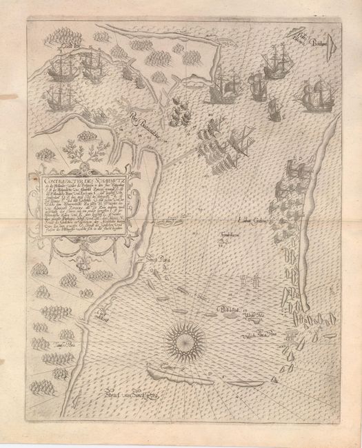
"Contrafactur des Scharmutz els der Hollender wider die Portigesen in dem Flus Balusabar…", Bry, Theodore de
Subject: Singapore
Period: 1607 (circa)
Publication: Petits Voyages
Color: Black & White
Size:
10 x 12.8 inches
25.4 x 32.5 cm
Download High Resolution Image
(or just click on image to launch the Zoom viewer)
(or just click on image to launch the Zoom viewer)