Catalog Archive
Auction 125, Lot 720

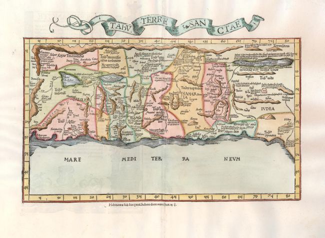
"Tabu. Terre Sanctae", Ptolemy/Fries

Subject: Holy Land

Period: 1525 (published)

Publication:

Color: Hand Color

Size:
16.5 x 9.5 inches
41.9 x 24.1 cm
Download High Resolution Image
(or just click on image to launch the Zoom viewer)

This important map of the Holy Land is based on the first 'modern' depiction of Palestine by Sanuto-Vesconte in 1320. The map is divided into the Twelve Tribes of Israel and covers the coast from Sidon to Gaza and inland to show the land on both sides of the Jordan. Rope-like mountain ranges dominate the topography of the map. The oversized Lake of Merom is called Mare Galilee, and the Dead Sea is shown as an elongated narrow lake. The map is oriented with east at top, in a configuration that set the standard for maps of the region for the next 150 years. Latin text and illustrations on verso.

References: cf Laor #612; Mickwitz & Miekkavaara (Nordenskiold) Vol. II #208-41.

Condition: A

Professional repair of some minor tears in the wide blank margins, none near the map.

Estimate: $1,500 - $1,800

Sold for: $1,400

Closed on 9/24/2008

Archived