Catalog Archive
Auction 125, Lot 562

"A New Map of Ancient Gaul or Gallia Transalpina…", Wells, Edward
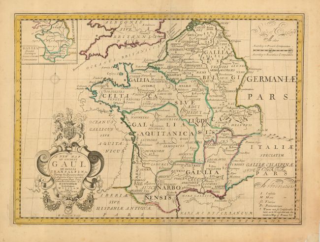
Subject: France

Period: 1718 (circa)

Publication: A New Sett of Maps Both of Antient and Present Geography

Color: Hand Color

Size:
19.3 x 14.3 inches
49 x 36.3 cm
Download High Resolution Image
(or just click on image to launch the Zoom viewer)

This is an attractive map of ancient France showing the divisions during the Roman period. The map is decorated with an elaborate title cartouche topped with the British arms. The maps from this atlas were designed by Wells, an Oxford scholar, for the education of his young pupil William, Duke of Gloucester, the son of Queen Anne. William suffered from encephalitis and died in 1700 at the age of eleven. Wells dedicated and published the atlas as a tribute to the Duke.

References:

Condition: B+

Lightly toned with original outline color. There are short centerfold separations in the blank margins, well away from the map.

Estimate: $200 - $250

Sold for: $100

Closed on 9/24/2008

Archived