Catalog Archive
Auction 125, Lot 487

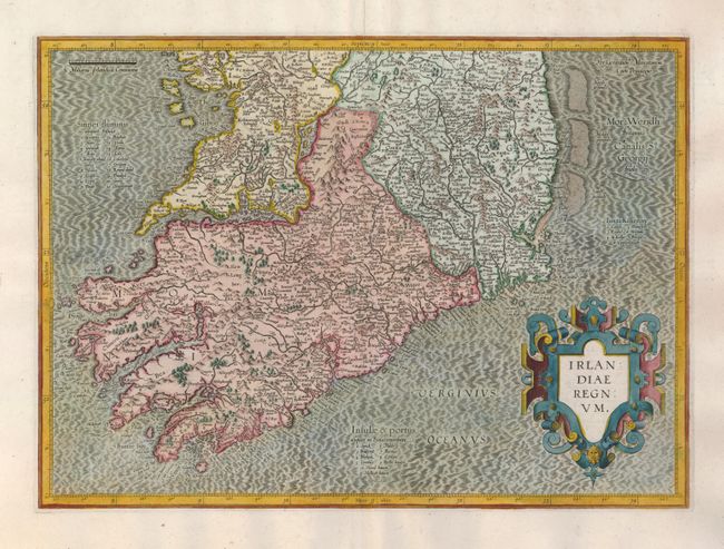
"[2 sheets] Irlandiae Regnum", Mercator/Hondius
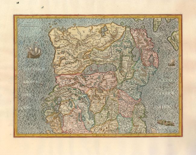
Subject: Ireland

Period: 1613 (circa)

Publication: Gerard Mercatoris Atlas

Color: Hand Color

Size:
18.5 x 13.3 inches
47 x 33.8 cm
Download High Resolution Image
(or just click on image to launch the Zoom viewer)

Superb early pair of maps covering the whole of Ireland compiled from his landmark map of Britain (1564). These two maps were among five Irish maps Mercator designed for the second part of his Atlas. The maps are richly engraved with a moiré pattern in the seas and strong topographical features in the interior. The northern section is decorated with sailing ships and a sea monster and there is no title cartouche - only Mercator's imprint. The southern sheet features the bold, strapwork title cartouche. Size is for each map. Latin text on verso.

References: Law, pp. 19-20.

Condition: A+

Margins of the southern sheet have been slightly trimmed, but are still very ample.

Estimate: $950 - $1,200

Sold for: $1,800

Closed on 9/24/2008

Archived