Catalog Archive
Auction 125, Lot 308

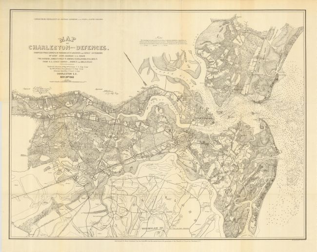
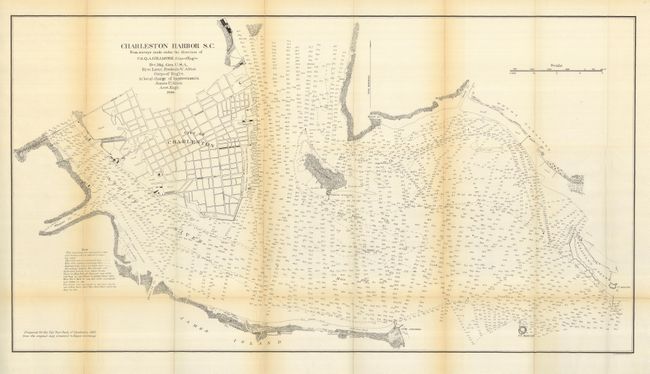
"[Lot of 2] Map of Charleston and Its Defenses… Nov. 28th 1863 [and] Charleston Harbor S.C. …1886",

Subject: South Carolina, Charleston

Period: 1885 (dated)

Publication: City Year Book of Charleston

Color: Black & White

Size:
See Description
Download High Resolution Image
(or just click on image to launch the Zoom viewer)

A pair of scarce maps that were created in 1885 for Mayor Courtenay's "City Year Book of Charleston 1885." A most uncommon pair of maps we've not previously encountered and for which we find little information.

1) This map shows the region surrounding Charleston with much detail of county roads, buildings, railroads, waterways, lighthouses, etc. Forts Sumter and Johnson are clearly shown and there are hundreds of soundings in the harbor. Extends west to well beyond Ft. Bull, south to Stono Inlet, and north to about today's Woodville. The major streets of Charleston are shown. Note above title states "Copied for his Excellency M.L. Bonham Governor…" from the original then in the possession of the Chamber of Commerce (25 x 19.5"). Folding, as issued. One fold with internal split. (A)

2) This detailed harbor chart shows the shoreline, many hundreds of soundings as well as a street layout of Charleston. Locates Fort Moultrie, Fort Sumter, Shute's Folly Island, Fort Johnson, etc. In Charleston the streets of Broad, Spring, Meeting, Calhoun, and East Bay are named. Also locates the town's cotton sheds and warehouses along the Cooper River and the mills along the Ashley River. Copied from the original presented to Mayor Courtenay (35 x 19") Folding, as issued with a little toning along horizontal fold and a clean split along two folds. (B).

References:

Condition:

See descriptions.

Estimate: $300 - $400

Sold for: $200

Closed on 9/24/2008

Archived