Catalog Archive
Auction 125, Lot 276

"Geological Map of Keweenaw Point, Lake Superior Michigan", Foster/Whitney
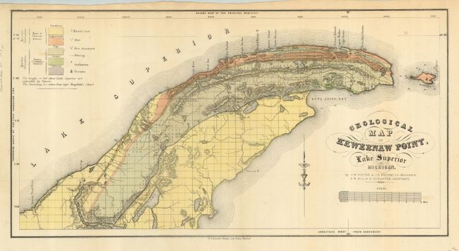
Subject: Michigan

Period: 1849 (circa)

Publication: Report on the Geological and Mineralogical Survey…

Color: Hand Color

Size:
23.2 x 12.2 inches
58.9 x 31 cm
Download High Resolution Image
(or just click on image to launch the Zoom viewer)

Very detailed geological map that covers the region from Salmon Trout River to the tip of the point and Bete Grise Bay and also shows all of Manitou Island. Color-coded key locates geological formations to include sandstone, conglomerate, trap, jasper, and chlorite. Legend locates mineral land, mines, abandoned mines, furnaces, and more. The majority of the point is indicated to be chlorite, but a strip to the west is quartz and feld spar. Soundings are taken from Capt. Bayfield's chart. Scale below title converts chains to miles. Fancy title lettering.

References: Karpinski (MI) #765; Marcou & Marcou #362.

Condition: A

Folding as issued.

Estimate: $120 - $160

Sold for: $75

Closed on 9/24/2008

Archived