Catalog Archive
Auction 125, Lot 244

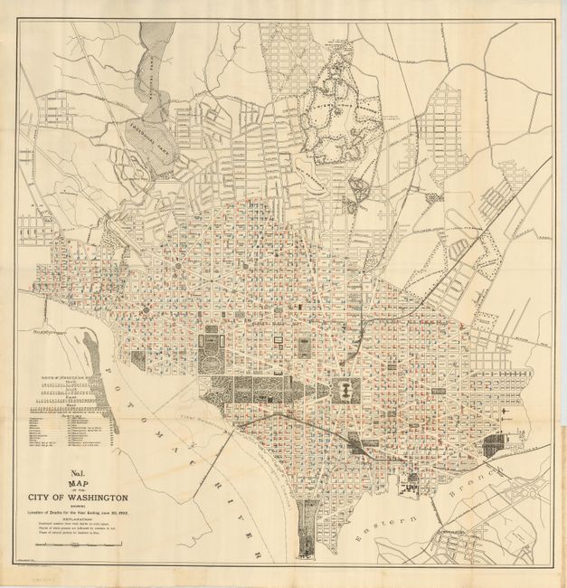
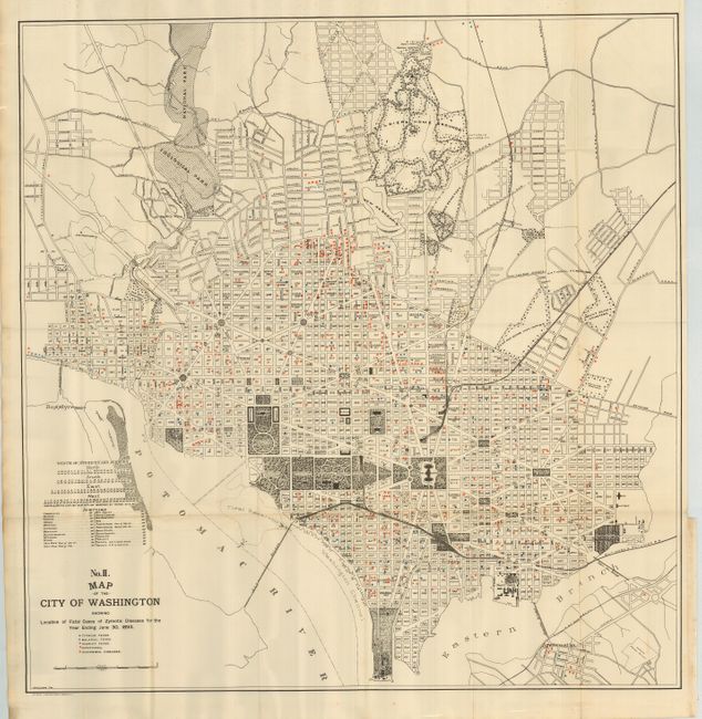
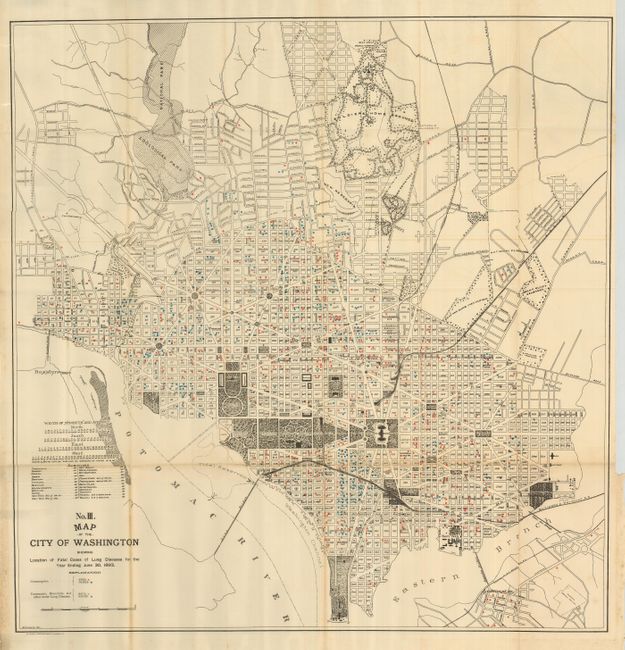
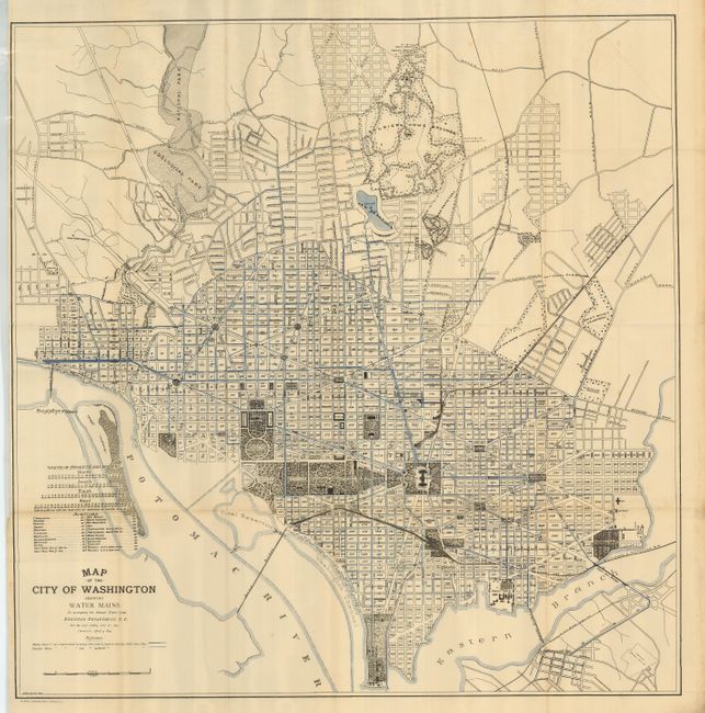
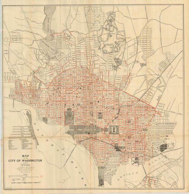
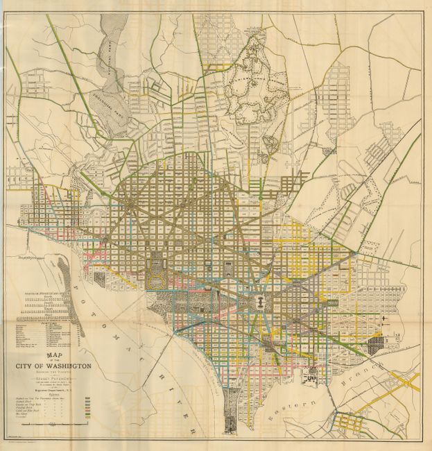
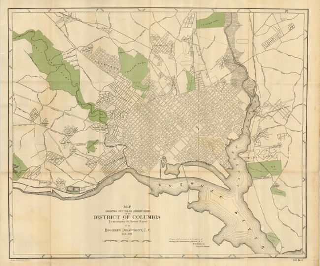
"[Lot of 7 Washington D.C.]",

Subject: District of Columbia

Period: 1893 (dated)

Publication:

Color: Printed Color

Size:
26 x 22 inches
66 x 55.9 cm
Download High Resolution Image
(or just click on image to launch the Zoom viewer)

Interesting series of thematic maps that provide detailed statistics and other information on public health and the infrastructure of the captial city in the mid-1890's. The maps are after the original Greene maps first published in 1880-81 to show the large-scale improvements in the infrastructure of the city. The first six maps use the same base map with overprinting to emphasis its theme. The title of each begins "Map of the City of Washington Showing..." The first three are related to public health: Location of Deaths for the Year ending June 30, 1893; Location of Fatal Cases of Zymotic Diseases…; and Location of Fatal Cases of Lung Disease…. Legend and coloring locate the numbers of deaths of whites, noted in red, and non-whites in blue. The next maps focus on infrastructure: Water Mains; Sewers; and The Varieties of Street Pavement. The pavement map is most colorful as it uses seven bright colors to indicate various street surfaces such as Asphalt and Coal, Granite, Vitrified Brick, etc. The final map is a "Map Showing Suburban Subdivisions of the District of Columbia To accompany the Annual Report of the Engineer Department, D.C., Jan.. 1894." This map is mostly black and white with green overprinting to highlight parks, observatories, institutes, asylums, the Soldier's Home, and other government facilities.

References:

Condition: B+

The maps are generally very good less some occasional fold toning.

Estimate: $300 - $400

Sold for: $200

Closed on 9/24/2008

Archived