Catalog Archive
Auction 125, Lot 23

"De Grondt en Vloer vande Groote Burger Sael", Anon.
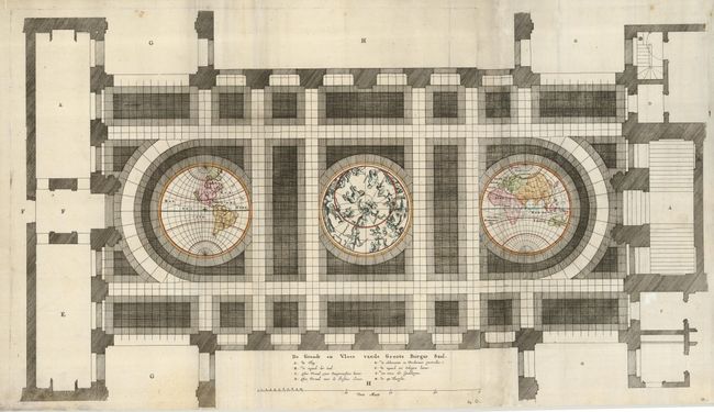
Subject: World

Period: 1661 (published)

Publication: Abfeelding van't Stadt Huys van Amsterdam

Color: Hand Color

Size:
29.5 x 17 inches
74.9 x 43.2 cm
Download High Resolution Image
(or just click on image to launch the Zoom viewer)

This unique sheet depicts three maps that were laid in the marble floor of Amsterdam Town Hall. At center is a celestial map of the northern sky with the Western and Eastern Hemispheres on either side. The maps are rudimentary with simple continental outlines and river systems shown. California is shown as an island as would be expected for a map of this period. However in the Eastern Hemisphere is one of the earliest depictions of Abel Tasman's discovery of Tasmania. Tasman made those discoveries in 1642-43. However, it was several years before the results of the exploratory voyages were made public due to the secretive nature of the East India Company and their desire to maintain its monopoly on trade in the region. The map appeared in Jacob van Campen's work detailing the Civic Hall of Amsterdam on thirty copper plates.

References:

Condition: B+

Some minor soil and toning with professional restoration along a couple of folds mostly affecting the floor rather than the maps.

Estimate: $900 - $1,300

Sold for: $650

Closed on 9/24/2008

Archived