Catalog Archive
Auction 125, Lot 231

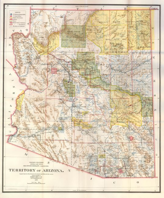
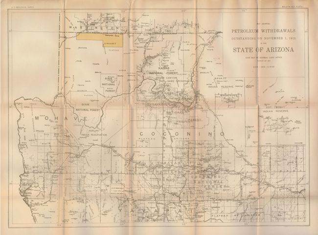
"[Lot of 2] Territory of Arizona [and] Map Showing Petroleum Withdrawals Outstanding on November 1, 1915 in the State of Arizona", U.S. Government

Subject: Arizona

Period: 1899-1915 (dated)

Publication:

Color: Printed Color

Size:
See Description
Download High Resolution Image
(or just click on image to launch the Zoom viewer)

1) Harry King, General Land Office, 1899, 17" x 20". This colorful and fascinating map contains remarkable detail and was published thirteen years before the territory attained statehood. The Indian reservations and military reservations, including Fort Apache, are clearly shown in different colors. Locates several Indian Reservations: White Mountain, Navajo, Moqui (Hopi), Gila River, Colorado River, and the Hualpai reservations. Private claims, confirmed and unconfirmed, are outlined in red. The Grand Canyon Forest Reserve is shown. Details include watershed, mountains, numerous railroads, wagon roads, private claims, unsurveyed townships, etc. The baseline and numerous standard survey lines, both north and south, are located. Folding as issued. Mint. (A+)

2) U.S. Geological Survey (USGS), 1912, 22.7" x 16.5". This map is a rarity we've not encountered before, nor do we find any references for it. Based on the 1912 (statehood) map by the General Land Office, it details the northern portion of Arizona from Camp Verde in the south just into Utah. Locates all forest reserves, Indian Reservations, roads and railroads, towns and villages, with good detail of topography and watershed. The Uinkaret region, which includes Antelope Springs and Cave Springs, is block colored but without any information on petroleum, as referenced in the title. Folding, as issued. A little fold toning, else very good. (B+)

References:

Condition:

See individual descriptions.

Estimate: $200 - $300

Sold for: $150

Closed on 9/24/2008

Archived