Catalog Archive
Auction 125, Lot 230

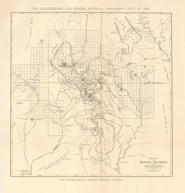
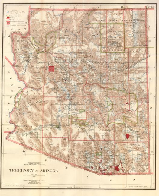
"[Lot of 2] Map of the Mining Regions around Prescott, Arizona [and] Territory of Arizona",

Subject: Arizona, Mining

Period: 1883-1896

Publication:

Color:

Size:
See Description
Download High Resolution Image
(or just click on image to launch the Zoom viewer)

1) This rare map of the mining region around Prescott Arizona by John F. Blandy was published in a supplement to the Engineering Mining Journal in 1883. The map extends to include People's Valley, Wickenburg and Camp Verde. This edition locates dozens of smaller, little known mining camps, most not showing up on King's map of 1896. Locates Bumble Bee Station, Model Mine, Bully Bueno, Kit Carson, Hanna, Schull, Kittie, Plata Bonita, Mars, Silver Belt, Atzlan Mill, and Happy Jack, to name just a few. Also locates the cliff dwellings known today as Montezuma's Castle. Note in the Iron Springs mountains reveals "Many Copper and Gold Ledges found in this range." 13.8" x 14", uncolored. 2) This highly detailed map shows the extent of nine Indian reservations and at least four military reservations including Fort Apache. Indian reservations are outlined in green, Military reservations are shown in solid red, and private claims, confirmed and unconfirmed, are outlined in red. The Grand Canyon Reserve is shown. The brown hachured mountain areas and the blue waterways combine to provide great visual impact. Information includes watershed, mountains, railroads, wagon roads, private claims, unsurveyed townships, etc. The Hopi reservation is still called the "Moqui" reservation. General Land Office, 1896, printed color, 16.8" x 20.3".

References:

Condition: A+

Both folded, as issued.

Estimate: $300 - $350

Sold for: $190

Closed on 9/24/2008

Archived