Catalog Archive
Auction 125, Lot 199

"Nebraska, and the Territories of Dakota, Idaho, Montana and Wyoming", Lloyd, H. H.

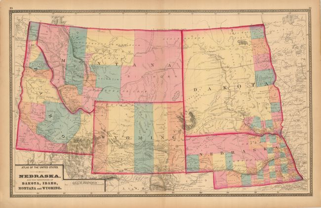
Subject: Central and Northwestern United States

Period: 1873 (published)

Publication: New Topographical Atlas of the State of Maryland and the District of Columbia…

Color: Hand Color

Size:
24.8 x 15.3 inches
63 x 38.9 cm
Download High Resolution Image
(or just click on image to launch the Zoom viewer)

This is a very attractive western regional map, based on the Johnson model. From the rare atlas by Martenet, Walling & Gray, published by Stedman, Brown & Lyon. This is plate 95/96 which extends from Idaho to Dakota Territory and Nebraska. Counties are shown via full hand coloring. The huge Dakota Territory is largely unsettled and blank, with counties only shown along the eastern boundary with Minnesota. Filled with interesting information and notations including the "New Worked Emigrant Road" in southeastern Idaho, the Pacific Telegraph Route, the Overland Route to the Gold Mines which departs the Emigrant Route at Deer Creek, Wyoming and heads toward Crow territory in Montana. Many place names including forts, Indian Tribes, and more.

References: Blevins, Mapping Wyoming #360.

Condition: A

Even edge toning and a couple of tiny edge tears or chips. Map is fine with beautiful original hand coloring, crisp impression and full margins.

Estimate: $140 - $180

Sold for: $100

Closed on 9/24/2008

Archived