Catalog Archive
Auction 125, Lot 156

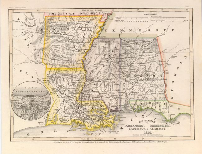
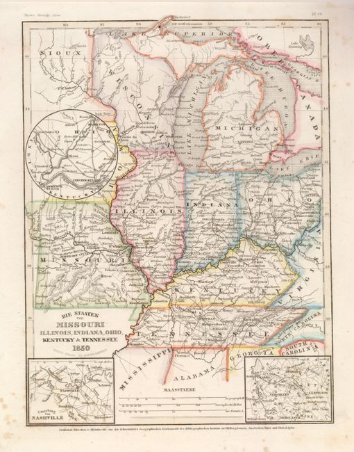
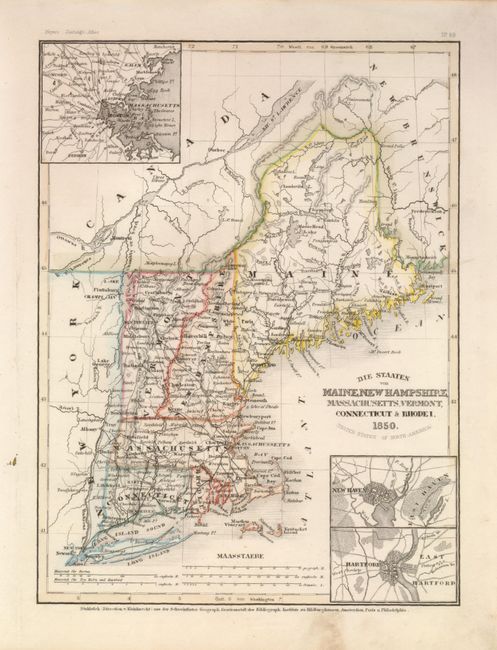
"[Lot of 3] Die Staaten von Arkansas, Mississippi, Louisiana & Alabama [with] Die Staaten von Missouri Illinois, Indiana, Ohio, Kentucky & Tennessee [and] Die Staaten von Maine, New Hampshire, Massachusetts, Vermont, Connecticut & Rhode I.", Geographisches Institut

Subject: United States

Period: 1850 (dated)

Publication: Meyer's Zeitungs Atlas

Color: Hand Color

Size:
8 x 10.3 inches
20.3 x 26.2 cm
Download High Resolution Image
(or just click on image to launch the Zoom viewer)

Great set of matching maps that feature the beautiful and detailed engraving style associated with German produced maps from this period. The first has a circular inset showing part of Lake Pontchartrain and New Orleans with the Mississippi River flowing between Red Church and Woodville. The second map shows a large unsettled area in today's Minnesota simply labeled "Sioux." With three insets: the first is untitled and details the region between Lawrenceburgh, Cincinnati and Hamilton; the second inset is the vicinity of Nashville; the last shows Lexington, Versailles, Franke and Georget. The third map contains three insets detailing the vicinity of Boston, New Haven and Hartford.

References:

Condition: A

Map images are fine with lovely, original hand color, sharp impression and full margins. The second with a little marginal soiling in lower margin, the latter a little marginal foxing, all easily very good.

Estimate: $150 - $200

Sold for: $110

Closed on 9/24/2008

Archived