Catalog Archive
Auction 124, Lot 749

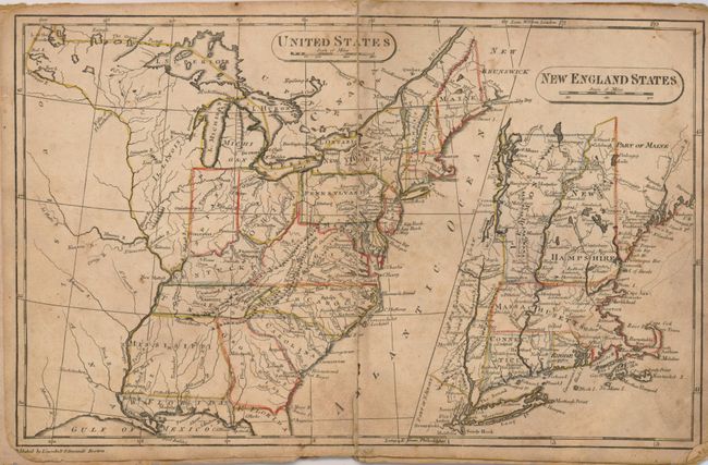
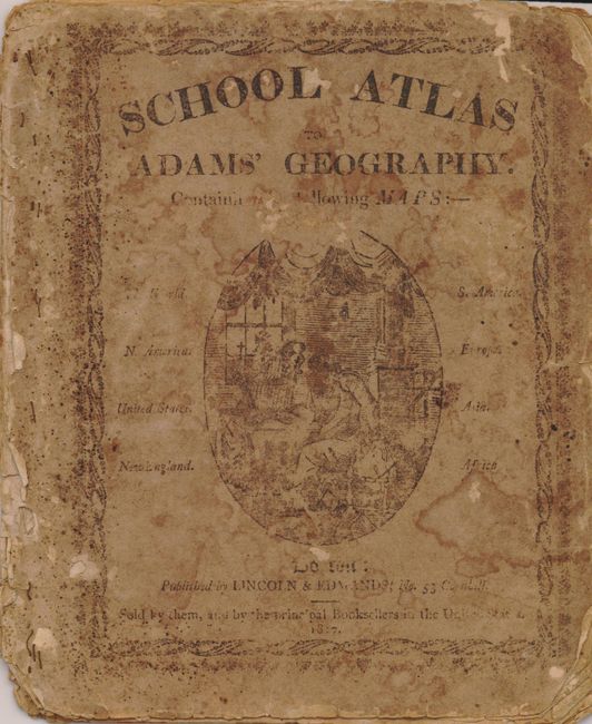
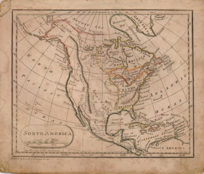
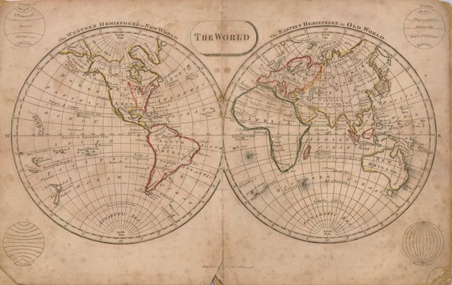
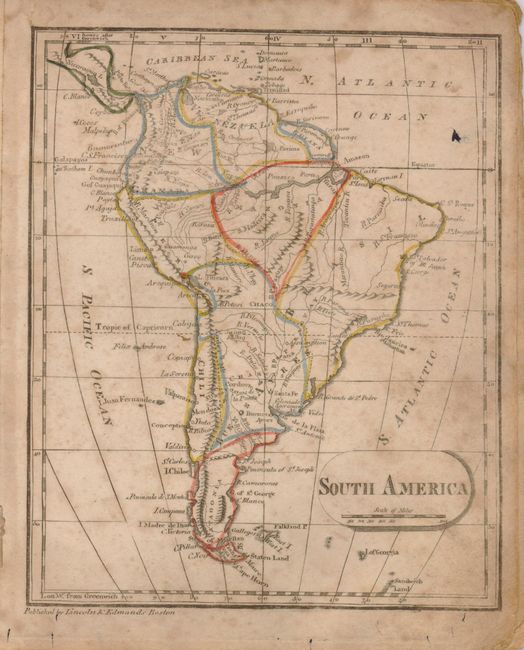
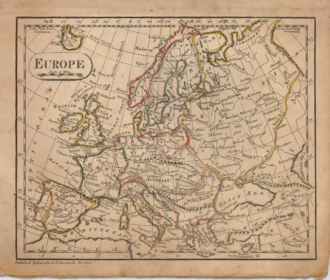
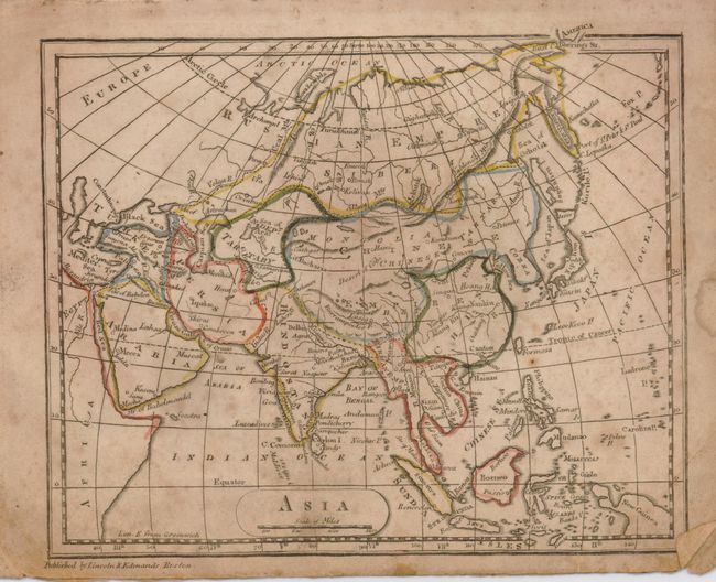
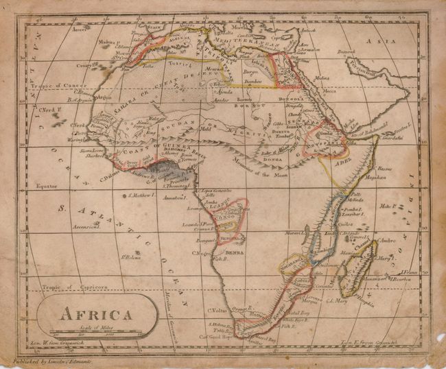
"School Atlas to Adams' Geography", Lincoln & Edmands

Subject: Atlases

Period: 1817 (dated)

Publication:

Color: Hand Color

Size:
7 x 8.3 inches
17.8 x 21.1 cm
Download High Resolution Image
(or just click on image to launch the Zoom viewer)

This scarce atlas contains five single-page and two double-page copper engraved maps. Each map is well detailed and shows topography, rivers, towns and much more. The map of the United States shows West Florida, a large Mississippi Territory that includes present day Alabama, and a very large Illinois taking up the entire northwestern portion of the country. The maps have delicate outline color, simple title cartouches and distance scales. Complete with eight maps on seven sheets. 8vo. Original soft covers with decorative title printed in black ink. This rare atlas was published by Lincoln & Edwards and "Sold by them, and by the principal Booksellers in the United States." This is the earliest example we know of - the Rumsey example is from 1819.

References: Rumsey #4.

Condition: B

The maps are lightly foxed and soiled, with edges worn. Centerfolds of all pages have splits to varying degrees and some minor worm holes. Front endpaper is chipped along edges and has a previous owners name in neat hand in ink. Rear cover and endpaper are missing. Front cover is soiled and quite worn with heavy chipping and a bit of loss. Binding is loose.

Estimate: $200 - $300

Sold for: $160

Closed on 5/7/2008

Archived