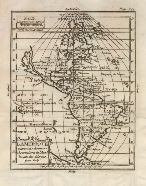
"L'Amerique Suivant les Dernieres Observations de l'Academie Royale des Sciences", Anon.
Subject: Western Hemisphere
Period: 1739 (published)
Publication:
Color: Black & White
Size:
5.5 x 7 inches
14 x 17.8 cm
This boldly engraved map of the Americas features California as an island. The map shows the major political divisions with very few place names or other information. Terre Australe still appears below Tierra del Fuego. There is a simple title cartouche at lower left and a distance scale at upper left. This is apparently a derivative of Denise Macquart's map, although it does not match exactly with McLaughlin's description. This example has page 841 in the upper left.
References: cf McLaughlin #73.
Condition: B
A dark impression with a repaired binding tear entering about 1.5" into the right side of the map.