Catalog Archive
Auction 124, Lot 476

"Carte du Royaume de France ou sont Tracees Exactement les Routes des Postes", Robert de Vaugondy, Gilles
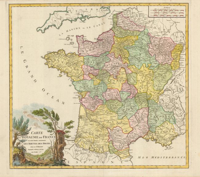
Subject: France

Period: 1762 (circa)

Publication: Atlas Universel

Color: Hand Color

Size:
20 x 18.5 inches
50.8 x 47 cm
Download High Resolution Image
(or just click on image to launch the Zoom viewer)

An attractive map of France showing the postal routes throughout the country. The cities on the mail routes are marked with a tiny circle. The decorative cartouche shows a landscape scene in which a postal worker and his mail-laden horse prepare to ascend to a remote monastery.

References: Pedley #86.

Condition: A

A good impression with attractive color. There is a very faint crease in the left side of the map. The centerfold has been reinforced on the verso with tissue.

Estimate: $200 - $275

Sold for: $350

Closed on 5/7/2008

Archived