Catalog Archive
Auction 124, Lot 454

"Plan of the Siege of Tournay", Tindal, Nicholas
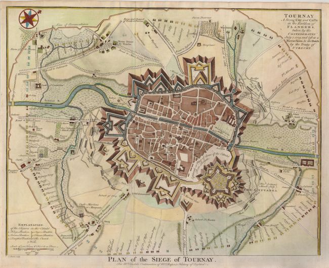
Subject: Belgium

Period: 1750 (circa)

Publication: History of England

Color: Hand Color

Size:
18.5 x 15 inches
47 x 38.1 cm
Download High Resolution Image
(or just click on image to launch the Zoom viewer)

Tournai, a town in southwest Belgium, was given to Austria along with the rest of the Spanish Netherlands by the Treaty of Utrecht in 1713, a series of documents and agreements that ended the War of Spanish Succession the next year (1701-1714). After 1815, it was part of the United Netherlands, and in 1830 it became part of Belgium. This map shows the fortifications and placement of the English forces in the successful siege of Tournai in 1709.

References:

Condition: A

Issued folding, now flattened with folds reinforced on the verso with tissue.

Estimate: $200 - $250

Unsold

Closed on 5/7/2008

Archived