Catalog Archive
Auction 124, Lot 435
"Royaume de Suede", Ratelband, Johannes
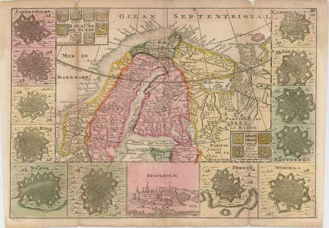
Subject: Sweden
Period: 1735 (circa)
Publication: Kleyne en Beknopte Atlas
Color: Hand Color
Size:
10.3 x 7 inches
26.2 x 17.8 cm
Download High Resolution Image
(or just click on image to launch the Zoom viewer)
(or just click on image to launch the Zoom viewer)