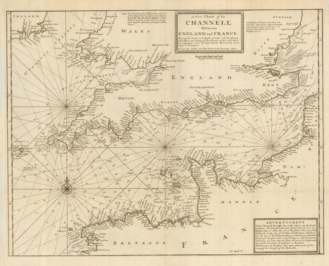
"A New Chart of the Channell between England and France…", Moll, Herman
Subject: English Channel
Period: 1701 (dated)
Publication:
Color: Black & White
Size:
22.8 x 17.6 inches
57.9 x 44.7 cm
A detailed chart of the Channel with particular attention to the movements of tides and currents from the observations of Captain Edmond Halley. The coastlines of southern England and northern France are well mapped, extending from Brittany to Calais, and from Suffolk to Cardigan, with a portion of the Irish coast and the Isles of Scilly. Sandbanks, soundings, and hazards are all meticulously noted. An Advertisement in the lower right hand corner describes how the mariner is to make use of the chart. Sold by Sellers & Price.
References:
Condition: A
A good impression on a sound sheet with folds as issued. The backstrap is still present on verso. One faint spot on Cardigan Bay, else fine.